Alboran sea eddies
Image of the Month - February 2013
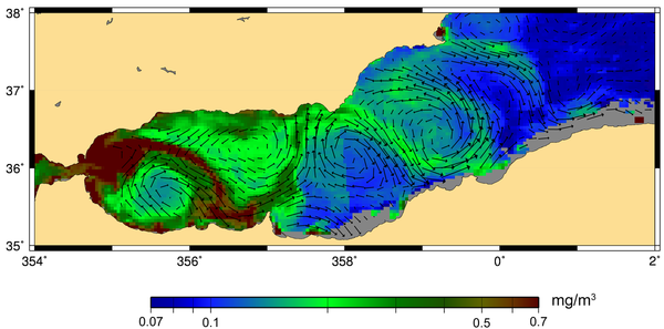
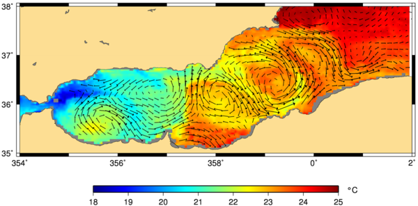
Waters from the Atlantic enter the Mediterranean Sea through the Gibraltar Straight. East, the Alboran Sea show two eddies, generated by the wake of the waters going through the narrow straight.
Alboran Sea eddies vary with the season, with a maximum in Summer. They can be seen by altimetry, but also but many kinds of remote sensing data. One can match all those sources of information, and observe that the waters from the Atlantic are colder, more nutrient-rich, than the Mediterranean waters.
On the reverse, Mediterranean waters join the Atlantic, but at depth. We will see another time how "meddies" (i.e. deep, warm, salty eddies) show on the sea surface heights of the Atlantic.
All the kinds of ocean remote sensing data each bring its own piece in the ocean puzzle, enabling to better understand, and better predict, the oceans and seas and their variations. Altimetry is an important piece of this, and the continuity of the sea surface height observations a critical point for a number of studies and applications.
See also:
- Applications: Mediterranean Sea
- Applications: Ocean circulation and its variations
- Data: Ssalto/Duacs near-real and delayed time multimission altimeter products
Websites on this subject:
- MyOcean project for Mediterranean ocean color, Sea Surface temperature and ocean forecasting data

