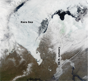
Melting in the Kara Sea
Image of the Month - April 2014


The new altimeter, AltiKa, onboard Saral (CNES/ISRO) continues to bring its share of results and studies. The spatial resolution of AltiKa is better adapted to study land hydrology ; we had a look in July 2013 (Image of the Month, Jul. 2013: Ob bogs and wetlands) at the first measurements of this altimeter on the North of Siberia. Further North of the Ob river, the Kara Sea is also seen by AltiKa, and the finer resolution also enable to distinguish there the effects of ice melting and also the presence of polylinias (areas free of ice on a frozen sea). Clear differences are visible between winter (in this case, April, the satellite having been launched late February) and the onset of Summer (July), with the melting of land and sea ice.
See also:
- Data: Saral (I)GDRs
- Image of the Month, December 2011: Missing: Water
- Image of the Month, July 2013: Ob bogs and wetlands
- Applications: Ice
- Applications: Hydrology and land
Website on this subject:
- Cryosphère satellitaire (Legos/CNRS) (in French)


