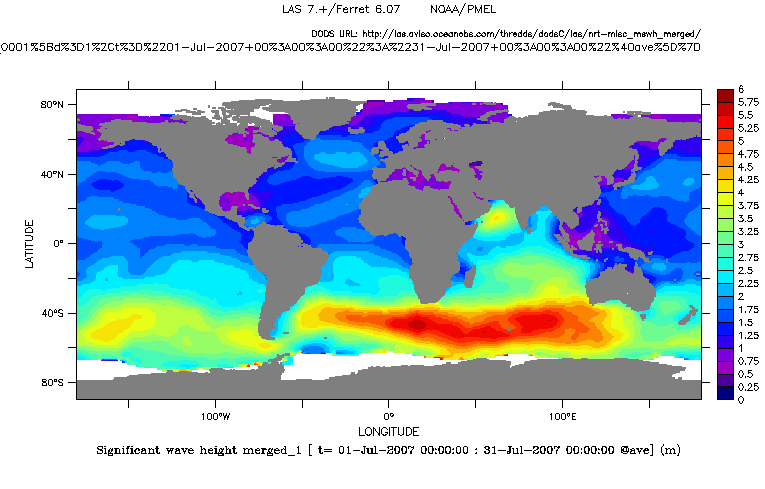
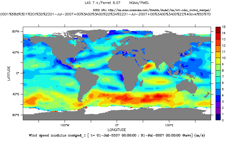
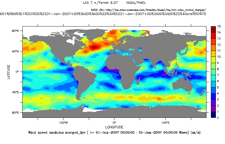
Significant Wave Height and Wind Speed Modulus
In addition to the dynamic topography, satellite altimetry is also used to map surface wind speed and wave-height.
Wind and wave dialog
Significant wave height and wind speed are shown in july 1998, units are metres and metres per second respectively. These figures highlight the relationship between wind speed and significant wave height: the faster the wind, the highest the waves.The lowest waves (dark blue) are mainly in tropical and subtropical oceans, where the smallest wind speed are recorded.
Seasonal variations
Outside the subtropical region, wave height and wind speed are highly dependent on the season, especially around the Antarctic, where winds and currents are not blocked by any continent.
In Southern hemisphere winter (july), strong winds blow at Cape Horn (South of America). On the contrary, in Southern summer (january), winds are milder, and able Cape Horn crossing by sailors. At the same time, winds are strong in North Pacific and Atlantic.

