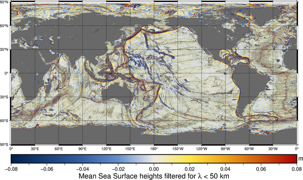
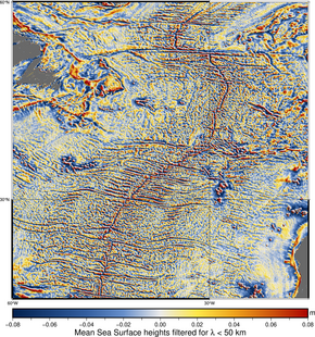
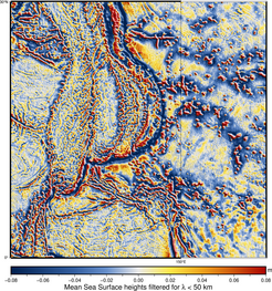
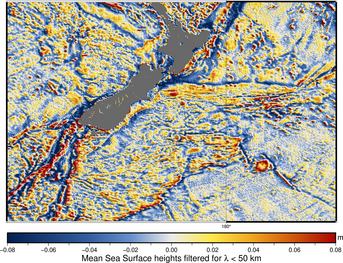
Ocean mirrors the (details of the) depths
Image of the Month - April 2024
The Mean Sea Surface is one of the reference surfaces computed for, and from, altimetry (and only altimetry). All possible altimetry data are used to evaluate the stable part of the sea surface height. This stable part includes the geoid (equipotential of the gravity field) and the mean dynamic topography (effect of stable currents on sea surface height). The geoid comprises the effect of undersea reliefs on the gravity field, and therefore the mean ocean surface too. By filtering it to keep only details smaller than 50 km, the effects of undersea reliefs on the surface appear. This, in combination with in situ measurements, can be used to deduce bathymetry, but also to calculate a better mean ocean topography, especially at Swot resolution, for which we need a better-resolved MSS to match the KaRIn swath resolution.
The Cnes-CLS22 MSS was used in combination with other solutions to produce the best possible surface - at this stage - for the Swot Calibration and Validation phase. After several years of Swot measurements, these will be taken into account and help in improving it further.
See also:
- Image of the Month, May 2017: Ocean mirrors the deep
- Image of the Month, December 2002: Ocean ridges
- Image of the Month, Jan. 1999: A glassy sea... of ridges and valleys
- Applications: Geophysics
- Applications: Bathymetry
- Data: Mean Sea Surface
References:
- Schaeffer, P., M.-I. Pujol, P. Veillard, Y. Faugere, Q. Dagneaux, G. Dibarboure, N. Picot, 2023: The CNES CLS 2022 Mean Sea Surface: Short Wavelength Improvements from CryoSat-2 and SARAL/AltiKa High-Sampled Altimeter Data. Remote Sens. 2023, 15, 2910. https://doi.org/10.3390/rs15112910
- Schaeffer, P. , M.-I. Pujol, , Y. Faugère, P. Veillard, Q. Dagneaux, G. Dibarboure, N. Picot, 2022: MSS_CNES_CLS2022 , OSTST 2022, Venice, November 2022.


