Internal tides by Swot
Image of the Month - January 2024
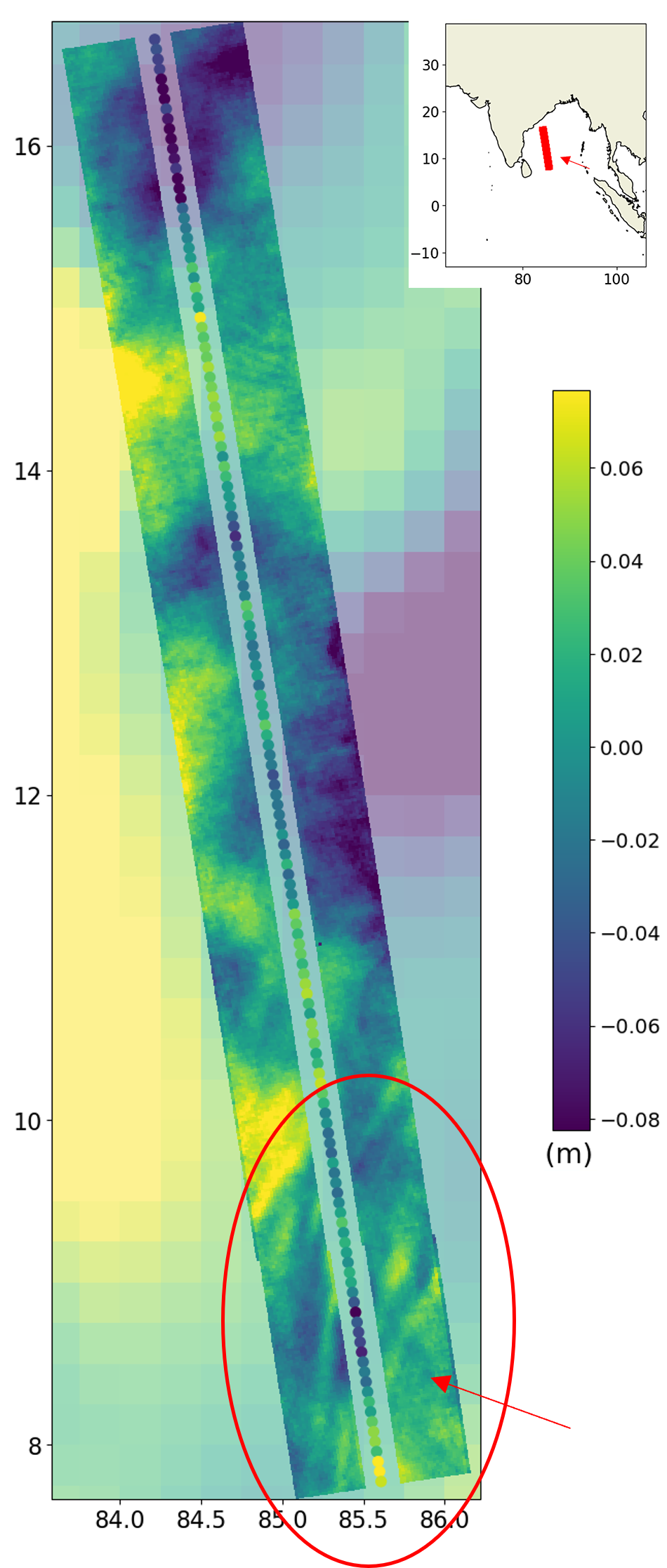
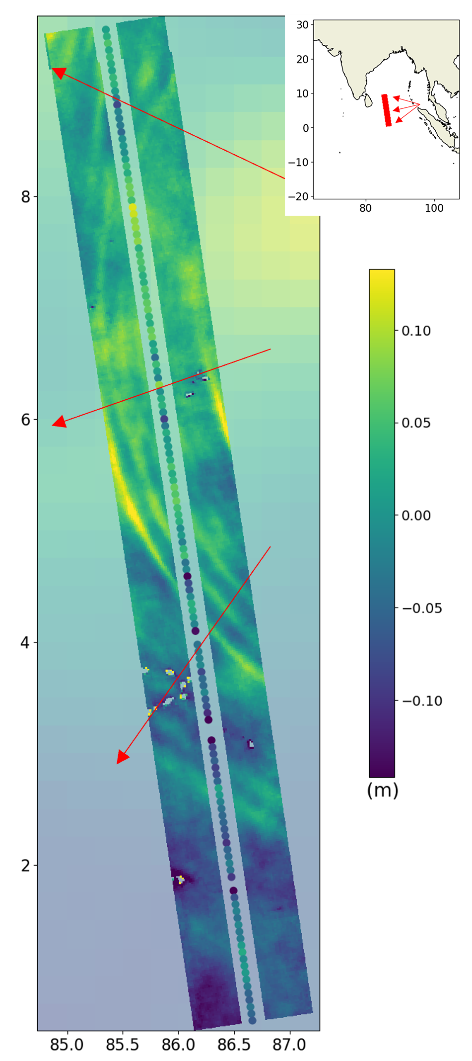
Tidal wave trains traveling westwards from the Andaman Sea through the entire Bay of Bengal. The individual wave ripples are 20-km large, with a wave front coherent over 1000 km - note that the two color scales are slightly different in th two images (Credit Cnes/CLS/JPL)
Internal tides are tides generated in a stratified ocean by the interaction of the external tide with sharp bathymetric features, much like the ripples of a river crossing a ford or a sill. They can often be seen in SAR (Synthetic Aperture Radar) images or even optical imagery at the ends of straits (e.g., Gibraltar or Luzon Straits). They propagate at the interfaces between ocean layers and affect the vertical mixing and thus the climate through the thermohaline circulation (see Nov. 2001: tides and the climate).
The internal tides surface signature can reach several centimeters in some locations. Swot has a lower noise level than conventional Nadir altimetry, and combined with its high 2D spatial resolution, it enables the mapping of coherent internal tides globally, as they radiate out from bathymetric structures.
As with conventional altimetry, the tides observed by the Swot wide-swath altimeter, KaRIn, are both an object of study and a correction to be removed to observe non-tidal ocean dynamics. The Swot "science" orbit has been chosen to avoid aliasing of the main tidal components: regular repeat observations at different stages of their cycle will allow them to be distinguished over the 3 years of the mission.
A number of different internal tide correction algorithms and models were developed as part of the Swot Science Team's activities during the preparation phase. Efforts to develop internal tide correction algorithms have also provided useful insights into how best to incorporate the Swot data into such models in the future to further improve their predictions.
However, a significant fraction of the internal tide Sea Surface Height data (SSH) variance is incoherent, i.e., out of phase with the local surface tides (e.g., because they have traveled a long distance since their generation). Observing them over several years will allow them to be better understood and taken into account in the computation of SSH data.
See also:
- Applications/ocean: Internal tides
- Missions: Swot
- Image of the Month, September 2022: Internal tides off the Amazon shelf change with the seasons
- Image of the Month, August 2020: Tides off the Amazon River mouth
- Image of the Month, September 2019: Internal tides in the Solomon Sea change with ENSO phases

