Altimetry and phytoplankton
Image of the Month - January 2003
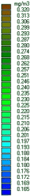


Sudden phytoplankton blooms are seem on ocean color images (here from the Vegetation sensor onboard Spot, between Africa and Madagascar). Those blooms can be correlated to the eddies and currents seen by altimetry (Ssalto/Duacs data) (Credits CLS)


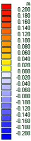
On the map combining altimetry and ocean color, phytoplankton is clearly less abundant in the warm waters of the "hills" (anticyclonic eddies) seen by altimetry (Ssalto/Duacs data), here west of Panama (Credits CLS)
Adeos-2 satellite was launched mid-December, with the ocean color instrument Polder-2 onboard. Such measures are interesting for understanding phytoplankton life cycle, with respect to the physical parameters of the ocean when combined with altimetry. More than forests this phytoplankton is producing the oxygen and recycling carbon. It is also the first element of the ocean food chain.
See also:
- Applications: Biology
- Applications: Mesoscale circulation
Websites on this subject:
- Plankton Blooms (Nasa)
- Polder (Cnes)

