Heat moves with the eddies
Image of the month - February 2006
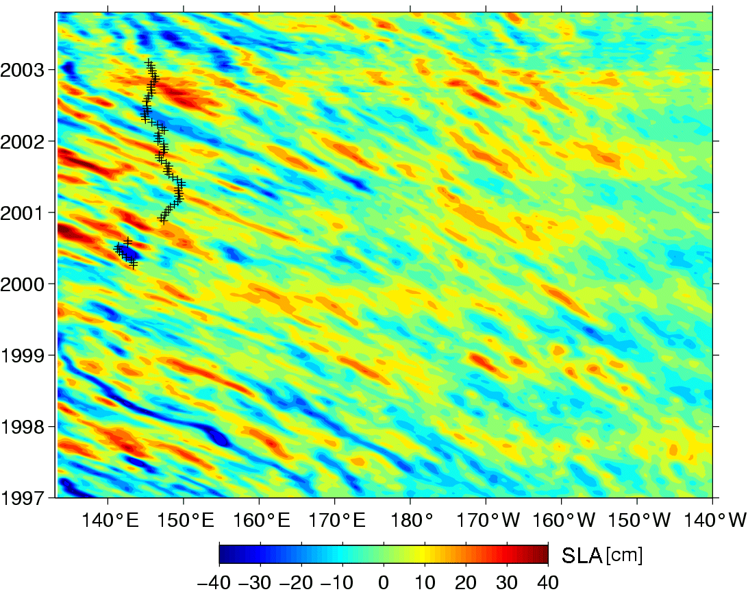
Longitude-time diagram showing sea level anomalies vs time in the North Pacific area, at 29°N. Red lines are westward propagating warm eddies. Crosses shows where there are Argo float measurements.
(Credits SOEST, University of Hawaii)
Heat is moved by the mean ocean circulation - the classical currents e.g. the Gulf Stream, Kuroshio etc (see Image of the month - January 2005 : Current heat). But heat transport is also made by eddies, and those induce variations in that transport, which in turn can cause climate variations.
Eddies are observed by altimetry, but altimetry does not give us information about the real structure of such features, neither about the temperature of them. By combining altimetry data with Argo float measurements we can have a deeper look at the heat transported by the eddies. Eddy heat transport is now being investigated in multi-sensors studies, with altimetry at the forefront.

An Argo float path along 2000 to 2003 (up) East of Japan, with measured temperature profiles along the years along the float's path (middle) and temperature anomalies (bottom). Warm eddies are visible on the temperature profile as warmer surface, that extend deeper with a time-lag on the temperature anomaly profile.
(Credits SOEST, University of Hawaii)
See also:
- Applications: Ocean
- OST/ST 2004 Poster: B. Qiu and S. Chen, Estimating Eddy-Induced Heat Transport by Combining Satellite Altimetry, Argo, and TMI Measurements (pdf, 2 Mb)
References:
- Qiu, B., and S. Chen, 2005: Eddy-induced heat transport in the subtropical North Pacific from Argo, TMI and altimetry measurements. J. Phys. Oceanogr., 35, 458-473.

