Argonautica buoys around a Tehuantepec eddy
Image of the month - November 2006
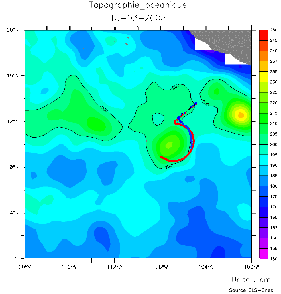
'Clipperton' (red) and 'Aladerive' (blue) buoys (the latter being built by students) around an eddy visible on the dynamic topography map on March 15, 2006.
(Credits Cnes/CLS)
The Argonautica project provides teachers and pupils with educational resources about the ocean and the marine environment for primary and secondary school classes. The aim is to show them how satellites are helping to further our knowledge of the oceans and protect the marine environment, and help them learn more about the oceans.
In that frame, maps showing ocean dynamic topography, geostrophic currents, winds measured by scatterometers, sea surface temperature and ocean color measured by satellites, as well as sea surface temperature, salinity and surface currents computed by Mercator global model, and Argos beacons trajectories are produced every week. Moreover, some buoys are built up by students, launched at sea and tracked.

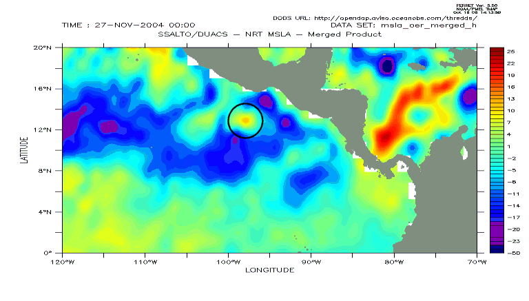
The eddy around which the Argonautica buoys are turning (black circle) over a dynamic topography map (top) and a Sea Level Anomaly map (bottom), where it is more visible. Animations show its evolution from its 'birth' near Tehuantepec Isthmus. This eddy is one of those called 'Tehuantepec eddies' (see Image of the Month of June and August 2006)
(Credits Cnes/CLS)
See also:
- Image of the Month, August 2006: Tehuantepec eddies: a multi-sensor's view on biology
- Image of the Month, June 2006: Tehuantepec eddies
- Image of the Month, August 2001: Currents, buoys and children

