Monsoons in the altimetry corrections
Image of the Month - December 2008
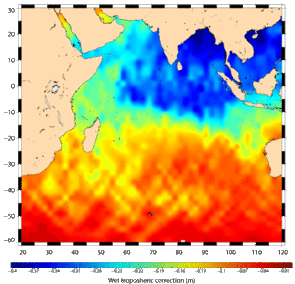
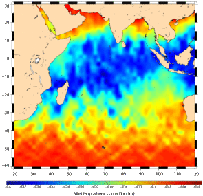
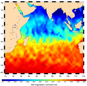
Correction of the delay of the altimeter radar wave introduced by water in the atmosphere (Wet tropospreric correction) from Jason-1 data, in July 2002 (cycle 20) and January 2003 (cycle 37). Note that this is a negative correction, so the lower the value (blue), the higher the quantity of water in the atmosphere (and thus the higher the slowing of the altimeter wave). In July, the monsoon is wet (even if in 2002 it was drier than normal), water vapor is closer to the Asian continent than in January, where the higher concentration of water vapour in the atmosphere is located closer to the Equator.
Monsoons are part of the climate of Tropical areas, especially North of the Indian Ocean. In summer (wet monsoon), land is hotter than ocean, so winds blow from the ocean to the land, thus bringing humidity. Moreover, when going North, the wet atmosphere encounter the reliefs of the Indian sub-continent, which trigger cloud precipitation. Wet monsoons bring much-needed rains, but too much or too little rain can be catastrophic, so their study, and forecast, are important. Altimetry can help, by giving information on water masses moves in the ocean. Moreover, since the altimeter radar wave is slowed down by water in the atmosphere, altimetry satellites usually have a radiometer instrument onboard, to measure such things (see Image of the Month, January 2000: Water, water in the air). Thus we can map water content in the atmosphere all along the more than 16 years of altimetry data now available, and look at both seasonal and year-to-year variations. Jason-2 is now continuing the series. In the future, the Saral altimetry mission (Cnes/Isro) will be a bit different, since it will use a different frequency for the altimeter (Ka-band). Concerning non-altimetric mission, Megha-Tropiques (Cnes/Isro) will be specifically dedicated to the measurement of the water content in the tropical zone.
See also:
- Lively Data, October 21, 2008: An unusually strong Indian monsoon
- Lively Data : August 28, 2006: A breath of air in Arabian Sea
- Lively Data : May 23, 2005: Looks on Indian monsoon
- Image of the month, August 2004: Summer: wet monsoon season
- Image of the Month, October 2002: Summer current, winter current
- Missions: Saral
Websites on this subject:
- Monsoon on line
- Megha-Tropiques (Cnes), Megha Tropiques Project (Isro) , a Cnes/Isro satellite dedicated to studying the water cycle in tropical areas
- AltiKa/Saral (Cnes website)


