Water or ice?
Image of the Month - February 2009
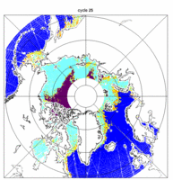
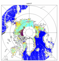
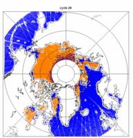
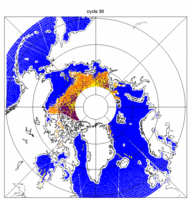
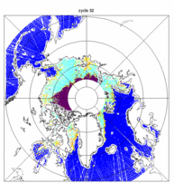
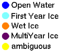
Ice types over the Arctic Ocean, as computed using Envisat altimeter and radiometer measurements, in March, May-June, July, September and November 2004. The cycle of ice forming/melting is clearly visible, as well as multi-year ice area (in dark violet) North of Greenland, well known from every study (see the whole 2004 series over the Arctic and also over the Southern Ocean, around Antarctica) (Credits CLS/Esa/Ifremer)
There are several ways to discriminate between water and ice using the altimetry satellites. One can observe if the radar wave returns earlier than expected for open water (see Image of the Month, November 2008: Counting Icebergs), or look at the shape of the returned echo. But one can also, as for continental ice use the fact that altimetry satellites have an onboard radiometer that measure the same areas at the same time than the altimeter (see Image of the Month, June 2008: sorting ice from space). By using both type of measurements mixed, not only the sea ice covered areas can be sorted from the open water, but a estimate of the ice age can also be done. Multi-year ice (ice that persisted more than one year) is rougher than first year ice (formed during the year), which lead to higher backscattering in the altimeter signal.
Using Envisat, that reaches 82° North and South, most of the potentially ice-covered seas can be observed. The satellite flies over the same point every 35 days, which does not enable real-time monitoring of ice movements, formation and melting. But it can still be very useful for seasonnal and inter-annual monitoring of the sea ice. Such measurements are also needed when studying such areas with altimetry, to know whether the measurement was done over open water or over ice, and adapt the processing to this.
See also:
Websites on this subject:
Global mapping of Arctic sea ice drift : a unique database (Cersat/Ifremer)
Reference:
- Tran,N., F. Girard-Ardhuin, R. Ezraty, H. Feng, P. Féménias, Defining a Sea Ice Flag for Envisat Altimetry Mission, IEEE Geoscience and Remote Sensing Letters, Vol. 6, No. 1, January 2009.
