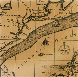
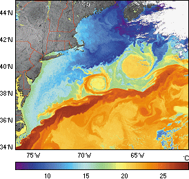
The Gulf Stream, which flows from the Caribbean to the Grand Bank off Newfoundland, is one of the first currents to have been studied scientifically, due to its importance for transatlantic shipping. Its temperature drops from 25° to 2°C during its course as it warms the ocean and releases heat and water vapour into the atmosphere. Like the Kuroshio Current, its counterpart in the Pacific Ocean, the Gulf Stream is a warm, western boundary current formed by easterly winds. It is very turbulent and exhibits sharp variations in direction, speed and temperature. The Agulhas and Brazil Currents in the Southern Hemisphere are similar.
Further information :
- Gulf Stream and Kuroshio as seen by altimetry on Google Earth (Download the kml file and open it in Google Earth).
- Image of the month, January 2005 : Current heat.
- Lively Data, June 17, 2005 : Kuroshio and Gulf Stream.
- Lively Data, August 17, 2005 : The seasons of the Gulf Stream.
- Lively Data, December 2009: On the borders of the Gulf Stream.
- Newsletter #4, 1996: Predictions of the Gulf Stream assessed with Topex/Poseidon data
- Gulf Stream predictions assessed with TOPEX/POSEIDON data external website, Radar Altimetry Tutorial, data use case : Western boundary currents: The Gulf Stream and its seasonal variations.
- K. Kelly et al., 2009: The Gulf Stream, Conveyor or switch? (pdf from the OSTST in Seattle).


