Aral Sea could be rising from the dust
Image of the Month - July 1999
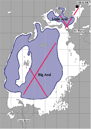
The Aral Sea has been drying up since the 1960s as a result of the large amounts of water diverted by cotton farmers from the two rivers feeding into it, the Syr Darya and the Amu Darya. Indeed, the shoreline has receded by more than 120 kilometers in places and the Aral Sea has since split into two basins, the Big Aral and the Little Aral, each supplied by one of the rivers.
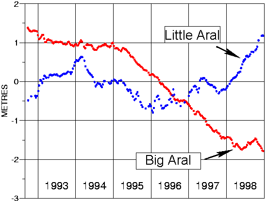
The water level in the Little Aral has been rising since 1996, probably due to the dike built between the two basins. The Big Aral, however, is still shrinking.
Oceanography satellites such as Topex/Poseidon measure sea level continuously over the long term and thus enable us to monitor variations in the Aral Sea.
See also:
- Aral Sea (regularly updated level)
Websites on this subject:
- Pictures of the Aral Sea
Aral Sea ("Visualizing Earth" programme , University of California at San Diego) - Remote sensing data and maps
Aral Sea by remote sensing (Remote sensing German Centre)

