Tuvalu islands under water
Image of the month - March 2004


Amplitude of the main semi-diurnal, lunar component of the tide (M2), left and of the diurnal component (K1), right, over the Tuvalu region. The semi-diurnal lunar component alone is responsible for sea level differences of about 60 cm over this area. (Credits Legos)
The Tuvalu archipelago, in the Pacific is a group of atolls, of very low altitude (2 m in average, 5 m maximum). If mean sea level rise in not (yet?) high enough to submerge those islands, they are regularly flooded during spring tides -- even the more when the atmospheric pressure is low. On February 20 such "king tides" flooded roads and houses, and salted the fresh water sources.
Other archipelago, like Kiribati or Maldives are thus threatened, and fear to eventually disapear. El Niño, rising water temperature that bleaches coral, or excavating works, weaken coral barrier reefs and may sink the islands.
Altimetry satellites measure sea level variations. They also help to improve further the tide models, especially in open ocean, and thus to have more and more precise forecasts?
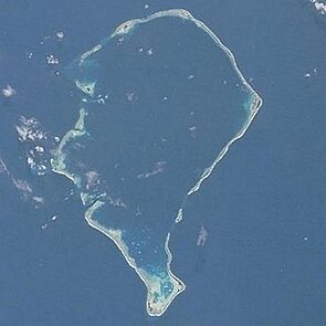
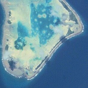
Funafuti, Tuvalu's capital island seen by the space shuttle (the whole atoll left, a zoom right) (Credits Nasa)

