Nida: altimetric view of a typhoon
Image of the month - June 2004
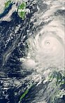
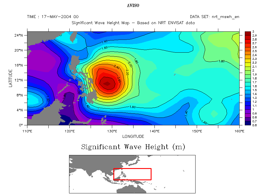
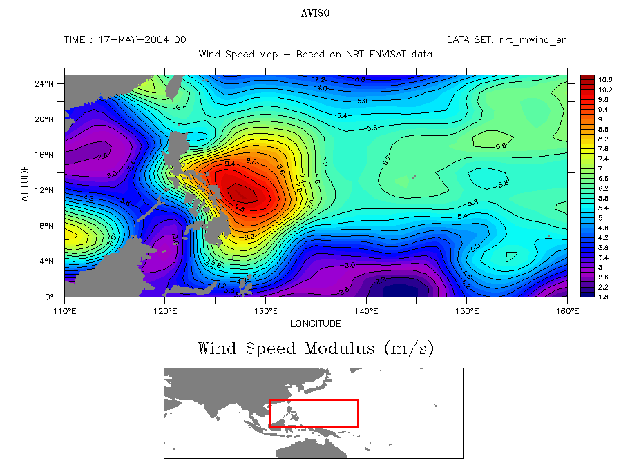
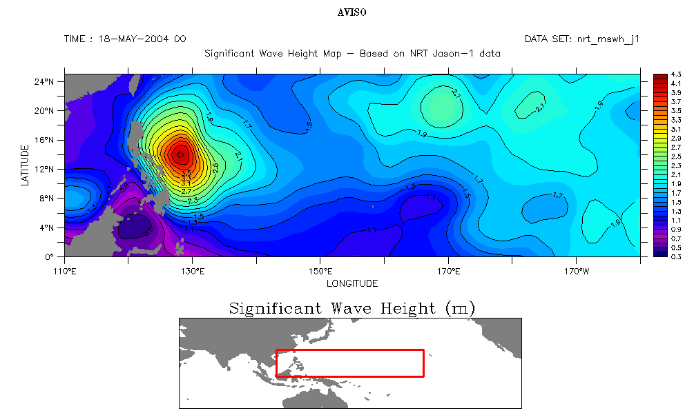
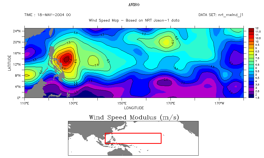
Nida typhoon seen by Envisat: left, Meris instrument on May 18 (ocean color), right, RA2 (altimeter) with significant wave height (up) and wind speed modulus (bottom) on May 17. Note that those two quantities are averaged, and may also not have been measured right over the strongest features; thus they are not as high as can be expected in a tropical cyclone. (Credits Esa, Cnes/CLS)
(see also Jason-1 wave height and wind speed, Credits Cnes/CLS)
Typhoon is the name given to tropical cyclones in South-East Asia (hurricanes in North Atlantic). Typhoon Nida struck Philippines on May 18, 2004 with winds over 150 km/h, and made considerable damages all over the archipelago, including casualties. Later on, Nida brought heavy rains over Japan. The Philippines get struck by around 20 storms and typhoons annually; indeed, not long after Nida, another tropical storm was spotted forming east of the islands.
Altimetry allows to measure wind speeds and wave heights in such tropical cyclones, and also helps to identify regions where they may intensify. It has been observed that many tropical cyclones have rapidly intensified when their paths traveled over oceanic warm features, such as anticyclonic eddies (see Aviso Newsletter 9: Using satellite altimetry to identify regions of hurricane intensification). The heat content of these warm features derived from altimetry can therefore then be used as a tool to identify regions that have the right oceanic conditions for tropical cyclone intensification.
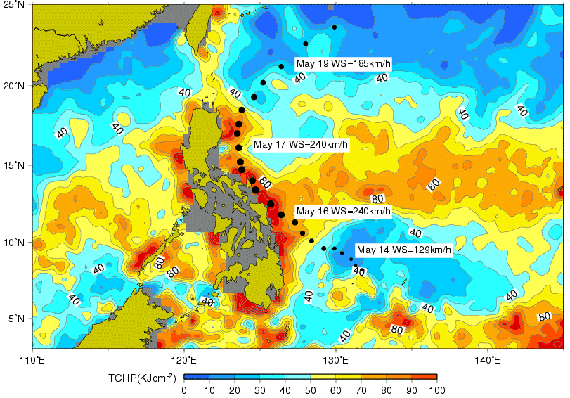
Tropical Cyclone Heat Potential, computed from altimetric measurements, and Typhoon Nida path with associated wind speed. The typhoon intensify when passing over areas of high Heat Potential (Credits Noaa/AOML)
See also:
- Aviso Newsletter 9: Using satellite altimetry to identify regions of hurricane intensification, G. Goni et al.
- Applications: Tracking hurricanes
- Applications: Hurricane Isabel under close monitoring with satellites
Websites on this subject:
- Near-real time estimates of upper ocean heat content (UOHC) and tropical cyclone heat potential (TCHP) from altimetry
- Typhoons, hurricanes and tropical cyclones:
- Hurricane Research Division FAQ
- Digital Typhoon: Typhoon Images and Information - Typhoon Nida:
- Digital Typhoon: Typhoon 200402 (Nida)
- Envisat catches the eye of Typhoon Nida (Esa)
- Super Typhoon Nida (Nasa)

