Pantanal wetlands
Image of the Month - April 2019
, 2002-2011 (Hydroweb)")
 since 2008, updated operationally (Hydroweb)")
Wetlands (non-rivers or lakes) have been much disparaged: source of epidemics, lands wasted for agriculture, etc. However the services wetlands are providing to the environment on biodiversity as well as climate, but also to economy, in particular by helping to mitigate disasters like floods or droughts, are more and more understood and recognized. Wetlands are now often protected areas, and labelled biodiversity hotspots.
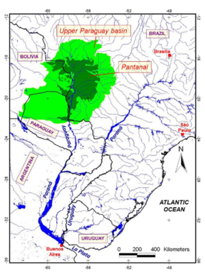
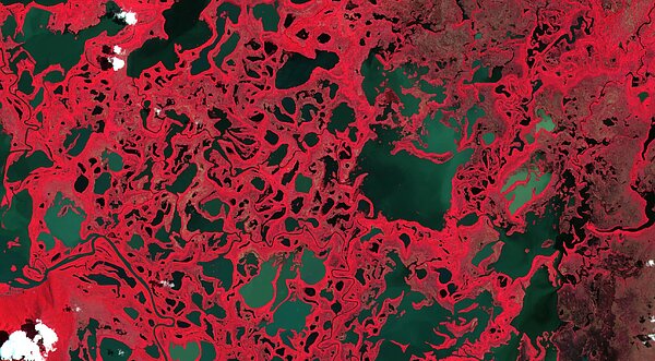
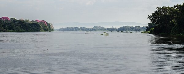
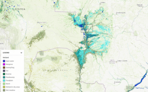
The Pantanal wetlands are the largest tropical wetlands on Earth with a surface of 150 000 km2. It shows a complex mix of tropical forest, savannah, and aquatic environments, with highly variable annual and interannual flood cycles. Annual floods may last as long as six months and cover as much as 100,000 km2. Altimetry water surface levels on the Paraguay river, one of the rivers feeding these wetlands clearly show this cycle and the amplitude of the floods, of about 4 m, while optical images such as Sentinel-2's show the flood spatial extend and the complexity of the area. Swot will enable to see both the temporal variations and the spatial complexity of the Pantanal wetlands' flooding.
See also:
- Applications / hydrology: Wetlands
- Applications: High-resolution hydrology
- Image of the Month, Mar. 2017: Satellites see the highs and lows of the biggest lake in China
- Missions: Swot
Other websites on this topic:
- Hydroweb on Theia web site

