From La Niña to El Niño, 20 years of Images of the Month on Aviso web site
Image of the Month - January 2019
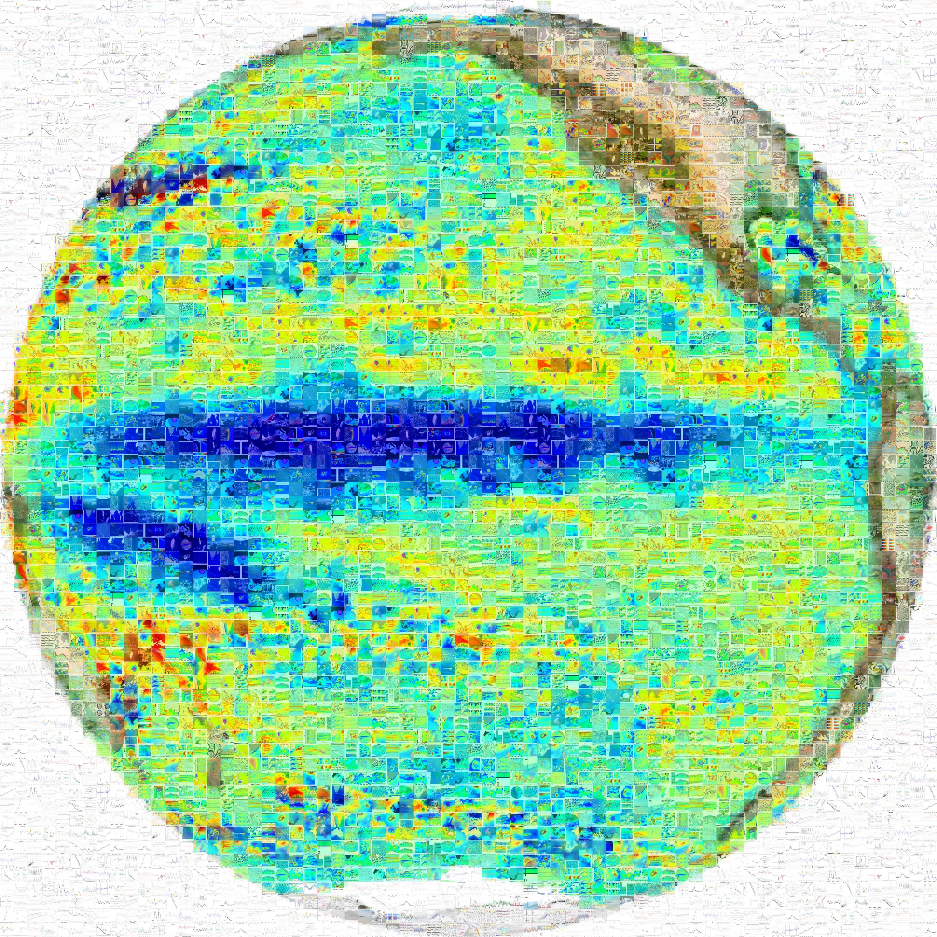
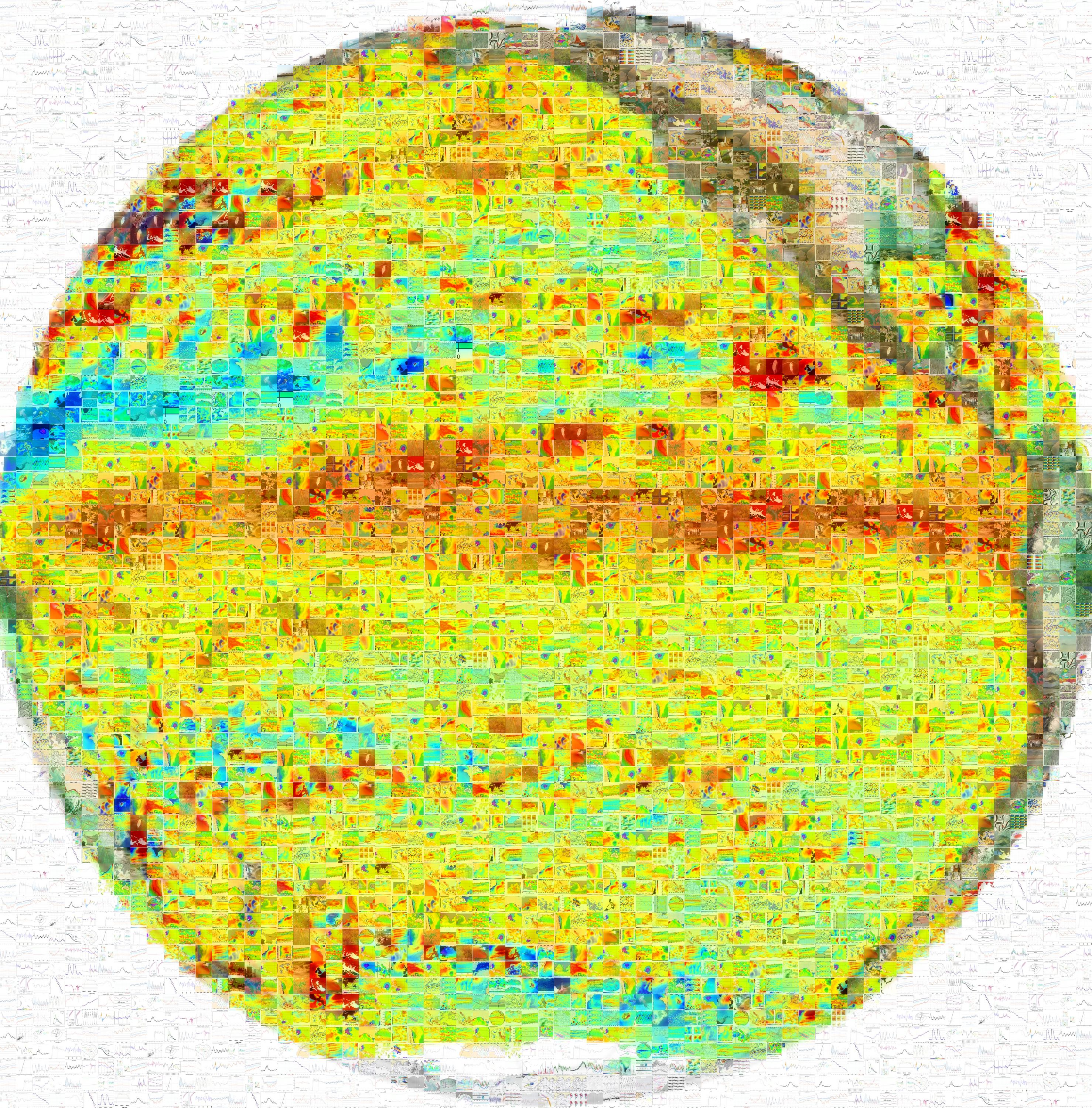

Mosaic of all "images of the month" (several occurrences of each image) in the shape of monthly average of sea level anomalies for November 1998 showing La Niña and Nov. 2018, with a weak El Niño.(Credits Aviso)
The Image of the Month began on Aviso web site 20 years ago - slightly more, in fact, since the very first one was in November 1998: From El Niño to La Niña.
In this period of weak El Niño (see the El Niño bulletin to monitor every month the Pacific sea surface height variation), we are remembering all the topics broached in this chronicles - from the most unlikely like a floating stone island monitored using a model assimilating altimetry, or like an analysis of the Kon Tiki voyage with respect to the currents to reccurring heroes like the Ierapetra gyre (June 1999, February 2007, ,...), not speaking of the all-time most starred one, ENSO (can't count!), or also frequent topics like typhoons, hurricanes and cyclones (seen by as many angles as possibles: wind, waves, sea level, rain.... models before and after). We also saw comparisons between altimetry and a zoo of different animals (crustaceans, jellyfish, penguins, elephant seals, turtles, fish ...). We visited the whole earth, from Sahara to Antarctica, from those deserts to wetlands, rivers and lakes. We listened to the sound of icebergs and monitored their path. We weighted the seasons or monitored Greenland glaciers'melting using Doris. We showed the developments in data, including high-resolution ones - filaments or models recently. Lately, Swot is more and more at the center of this Image of the Month, to show you all what is done to prepare the future mission, and all it will bring to you, whether as altimetry user, or as inhabitant of this planet. e.g. sea level rise is one of the discussion which went at the recent COP24.
This chronicle aims at several objectives: first, to have you discover all what is possible to do with satellite radar altimetry (and Doris), alone or in combination with other satellite-born sensors, or with other techniques (in situ or models, in particular). Second, to promote the work of our users, their innovations and discoveries. And, in part, as a kind of challenge - for how long will we manage to continue without repeating ourselves?
So we began telling stories of altimetry in November 1998, and continued... and cont'd... since our users are always finding new ideas to use the data, especially taking benefit of the continuous long period now available - 26 years since Topex/Poseidon launch. Thanks to all who have contributed along the years: we couldn't have done it without them!
We do hope you enjoyed our stories, and will continue doing so in the future!
See also:
- the Images of the Month complete series
- Data: the whole Aviso+ catalogue of products
- and the rest of the web site!

