Antarctic megadunes seen in a Digital Elevation Model from altimetry
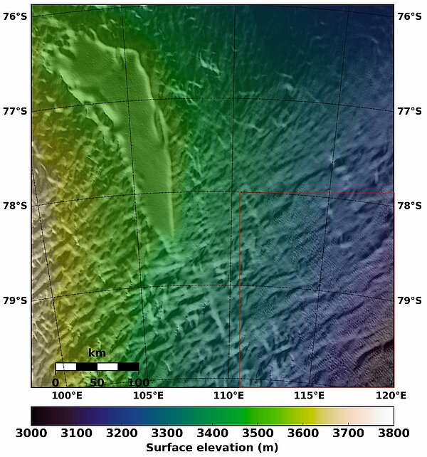
Slightly more than one century after its interior was explored (South pole was reached in 1911), we are still discovering the Antarctic continent, with the help of space techniques - insensitive to the harsh condition of the place. A number of specific features have been pinpointed which still need studies to be fully understood. For instance, megadunes are an Antarctic endemic feature, only known for a decade or so since they can only be really seen from above, from planes or even better from space. They consist of large fields of dunes, widely spaced (2 to 6 km), and about 1 to 8 m high, present in some areas of Antarctica. The supposition is that they are produced by repeated katabatic winds, fierce winds (reaching 300 km/h at coastal level) blowing down a slope because of gravity.
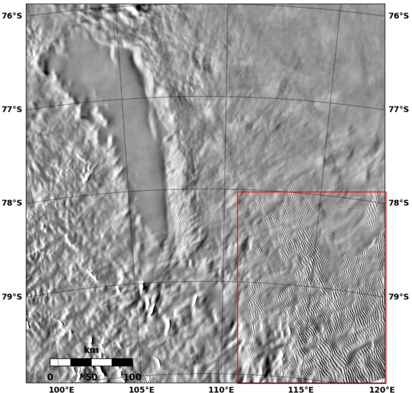
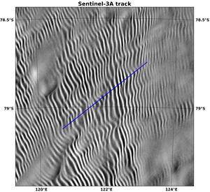
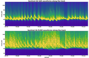
Optical images show the dunes but they can also be observed in altimetry. The improved along-track resolution of the SAR altimetry mode (300 meters) compared to conventional altimetry Low Resolution Mode (LRM) allows to reach these fine topographic scales.
Such results were obtained in the frame of the generation of a Digital Elevation Model (DEM) (CLS, funded by CNES). This new Digital Elevation Model is being built with the current altimetry constellation monitoring polar areas (Cryosat-2, Saral & Sentinel-3A). Thanks to the SAR altimetry mode of Sentinel-3A (Cryosat-2 is not in this mode over this area), the megadune fields are revealed. Monitoring the Antarctic topography is crucial to better understand past, present and future climates, and such a monitoring is better made by satellites especially over this continent.
See also:
- Applications: Ice
- Image of the Month, August 2000: A lake capped by ice
- User corner: Altimetry & glaciology workshops (mostly in French)
Other websites on this topic:
- Antarctic Megadunes (Earth Observatory, Nasa)
- Antarctic Megadunes: Research at the Edge of the Earth (NSIDC)
References:
- J. Aublanc, P. Thibaut, T. Moreau, C. Lacrouts, F. Boy, A. Guillot, N. Picot, A review of the current altimetry mission performances over the polar ice sheets: Cryosat-2, AltiKa and Sentinel-3A, OSTST 2017 meeting, Oct. 2017, Miami, USA.

