Fifty years ago...
Image of the Month - August 2019

We are celebrating a fiftieth anniversary this month. Not the first man on the Moon, but a much less advertised one, if one with very long-lasting effects: fifty years ago, August 11-21, 1969, a meeting took place in Williamstown, Massachusetts, USA, "to explore the possible contributions of accurate position, velocity, and acceleration measurements to the solution of problems in solid-earth and ocean physics and to make program recommendations." Over 65 scientists participated, including four French scientists and engineers some of whom helped lead the development of the French radar satellite altimetry program (ultimately Poseidon), thus laying the foundation for the Topex/Poseidon mission.
Among the recommendations, the development of precision measurement of satellite elevation above the sea surface using radar altimeters is very clear and repeated. This meeting and the subsequent report also asserted the possibilities for a space-based mission to determine the equipotential figure of the Earth using a combination of accurate Doppler and laser tracking of satellites [i.e. Doris and LRA...]. There are also mentions of the ionosphere and troposphere corrections of altimeter measurements, the need to use pulse compression techniques to reach the desired emission frequency, the fact of having a calibration program and a strong implication of the scientific community...
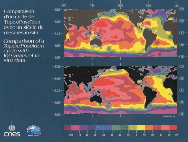
Twenty-three years later, nearly to the day (August 10, 1992), Topex/Poseidon was launched. It was the first altimeter which fulfilled some of the requirements listed, such as a 10 cm accuracy (or less) on sea surface measurement.
In memory of Michel Lefebvre, who told us our history -- among other stories.
See Also:
- Techniques/Altimetry: History
- Missions/Past missions: Topex/Poseidon, Thirteen evenful years
Other websites on this topic:
- Club des Argonautes : Williamstown - 1969
References:
- The terrestrial environment: solid-Earth and ocean physics, 1969, NASA report CR-1579 (report of the Willamstown meeting)


