Cloudy skies
Image of the month - June 2005
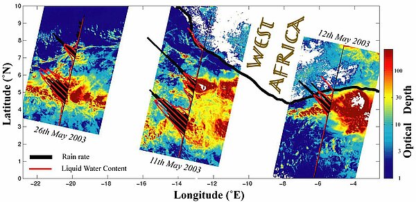
Ocean altimeters are designed for sea surface height measurements. However, with all the ancillary instruments, and with the two-frequency radar altimeters, the possibilities arise of looking at other things. For example, atmospheric liquid water content is a necessary measurement to correct altimeter heights (water in the air slows the radar waves). But it can also be used for that knowledge in itself, and compared to the altimeter measurements, since both frequencies respond differently to rain. On multi-sensor satellites like Envisat, other instruments can add complementary information, too.
Such studies enable us to gain a better knowledge of rain mechanisms, and also to improve altimeter corrections, thus providing better and better data accuracy.
See also:
- OST/ST 2004 meeting poster: Coincident cloud observations by altimetry and radiometry, G. Quartly and C. Poulsen (pdf, 3.4 Mb)

