Forecasting at oceans' scale
Image of the month - November 2005
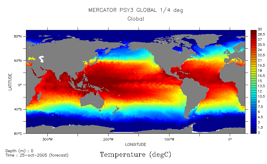

On October 14, 2005, the first Mercator global 1/4° ocean forecasting bulletin was published, one of the few of its category in the world. Like the other two Mercator bulletins (1/3° bulletin over North and Tropical Atlantic, and 1/15° over North Atlantic and Mediterranean Sea), this bulletin forecasts the ocean in surface and in depth, two weeks in advance, and assimilates altimetric data (Near Real time Envisat, Jason-1 and GFO Ssalto/Duacs data) that contributes to keep it close to reality.
Horizontal resolution of this new system goes from 6 km at the pole to 26 km at the Equator, which allow to simulate mesoscale eddies when they are seen by altimetric satellites, but not to generate them. Vertical resolution is 46 levels, with thinner layers near surface than in the depths, in order to modelize as well as possible the phenomena occuring in the first 500 m of the ocean.
Today ocean forecasting is one of the major applications of altimetry. Search and Rescue, hurricane intensification forecasting, seasonnal forecasting, coastal and ecosystem modeling... will now profit from this wider scale in forecasting.
See also:
- Applications: Operational oceanography
- Data: Ssalto/Duacs (Data Unification and Altimeter Combination System) Products

