Up North
Image of the Month - February 2012
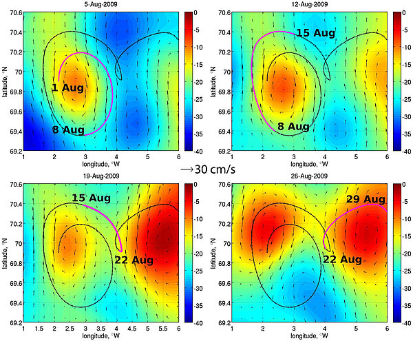
High-latitude satellite altimetry data have hardly been used, because of sea ice, and also because a lot of available data (Topex/Poseidon, Jason-1 and 2) does not extend beyond 66°N and 66°S. ERS-1, 2 and Envisat, however, have measured the polar oceans up to 82°. Generally, only one satellite can be used at a given time in the polar areas, while the use of merged measurements from several satellites at lower latitudes improve the quality of altimetry products.
However, the comparison of a satellite altimetry data product with available in situ measurements (tide gauges and drifters) in the Nordic, Barents, and Kara seas demonstrates that the new generation of altimetry products can be successfully used to study oceanic variability in the region.
Further developments, such as the near-real time Arctic data set (released last month) and the use of Cryosat-2 data (with measurements up to 88°), are expected to provide an even better data quality in the area.
See also:
- Data: Ssalto/Duacs near-real and delayed time multimission altimeter products
- Applications: multi-sensor applications
References
- Volkov, D. L., and I. Pujol (2012), Quality assessment of a satellite altimetry data product in the Nordic, Barents, and Kara seas, J. Geophys. Res., doi:10.1029/2011JC007557, in press.
- Volkov, D., I. Pujol, 2011: Quality assessment of a satellite altimetry data product in the Nordic and Kara seas, poster, OSTST meeting, San Diego, October 2011

