Getting smaller details
Image of the Month - September 2012
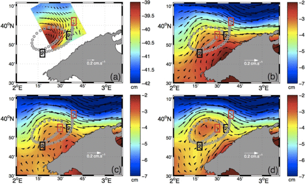
The merging of multiple altimeter missions improves the resolution of altimetry-derived maps. But the present configuration still lacks enough resolution for correctly sampling regional and coastal features. The Mediterranean Sea is an especially difficult area in this respect, since we are never far from shore. On the other hand, quite a lot of observations are available within this Sea.
To be able to detect smaller features, a second processing is done, to interpolate at smaller scale. The bathymetry is also taken into account, as it affects coastal circulation.
The future SWOT mission will completely change this kind of approach, by providing an image thanks to the swath measurements. In the meantime, and even afterwards to complete this mission, combining altimetry missions between them, and with other kind of data will enable better space/time resolutions.
See also:
- Data products: Ssalto/Duacs (Data Unification and Altimeter Combination System)
- Altimetry: Multiple satellite for high-precision altimetry
- Applications: Mediterranean Sea
References:
- Escudier, R., J. Bouffard, J., A. Pascual, P.-M. Poulain , M.-I. Pujol: Improvement of coastal and mesoscale observation from space: Application to the Northwestern Mediterranean Sea. Submitted to Geophysical Research Letters, 2012.
- R. Escudier, A. Pascual, J. Bouffard, J.M. Sayol, A. Orfilla, High resolution altimeter gridded fields for coastal and regional studies: applications in the Western Mediterranean, 2011, OSTST meeting, San Diego, October 2011

