Exceptional flood on the Amazon river
After months of heavy rains, the Amazon river sustains large floods. Satellite altimetry can make a major contribution for monitoring fluctuations in continental waters.
Since the beginning of the year, the Amazon basin is going through a severe flood. All its major tributaries were filled simultaneously to rise the Amazon waters whereas usually their flood peak spead out over time.
In situ water level measurements made by a Brazilian-French partnership near Obidòs (at 125 km downstream of the curves shown below) found a level never reached.
In isolated areas, in situ measurement systems suffer in particular from maintenance problems, not to mention difficulties related to distribution and intercalibration of data. Satellite remote-sensing techniques and in particularly, satellite altimetry have enabled new hydrological applications to be developed for monitoring fluctuations in continental waters. For rivers, flooded areas, etc., the level, flow rate, profile, slope, volume, levelling and water balance can all be measured in this way.
 | ||
|---|---|---|
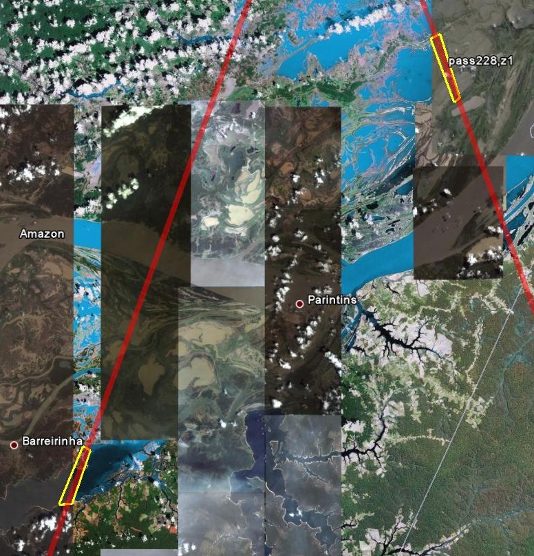
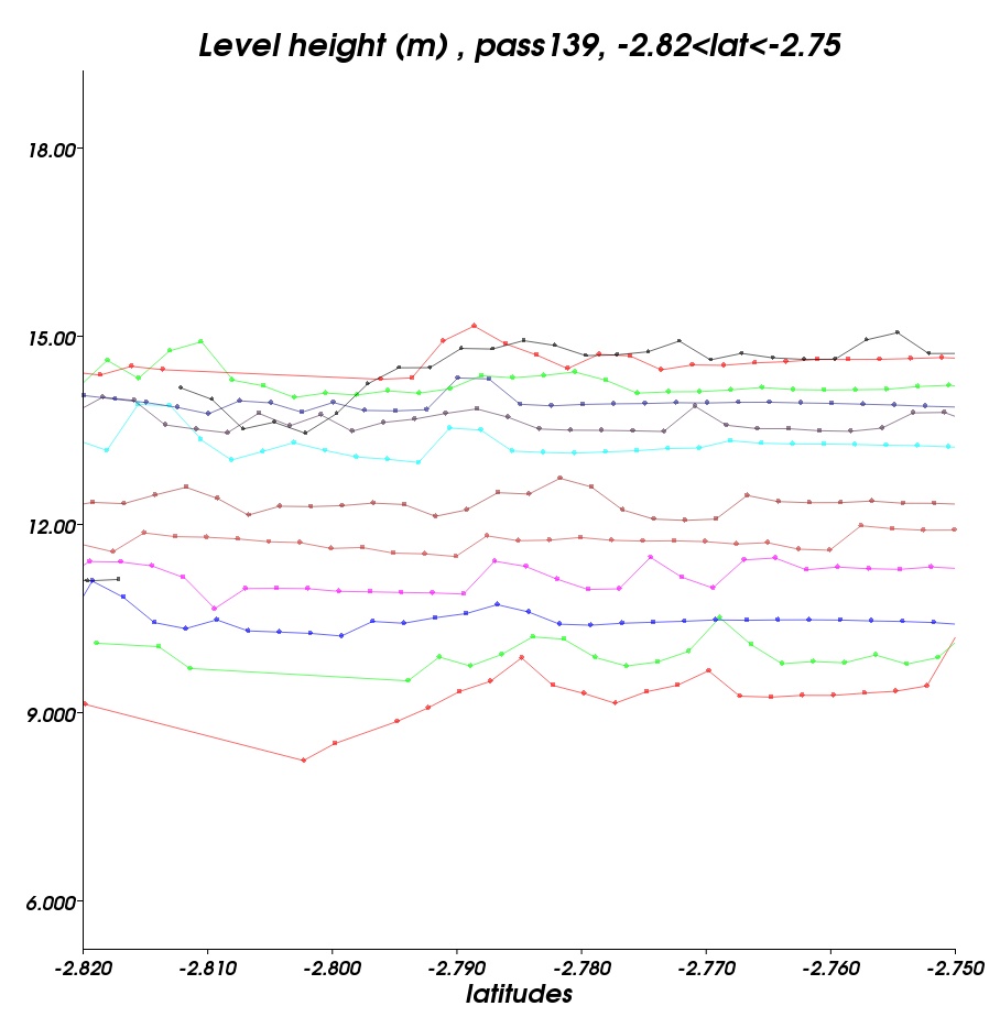
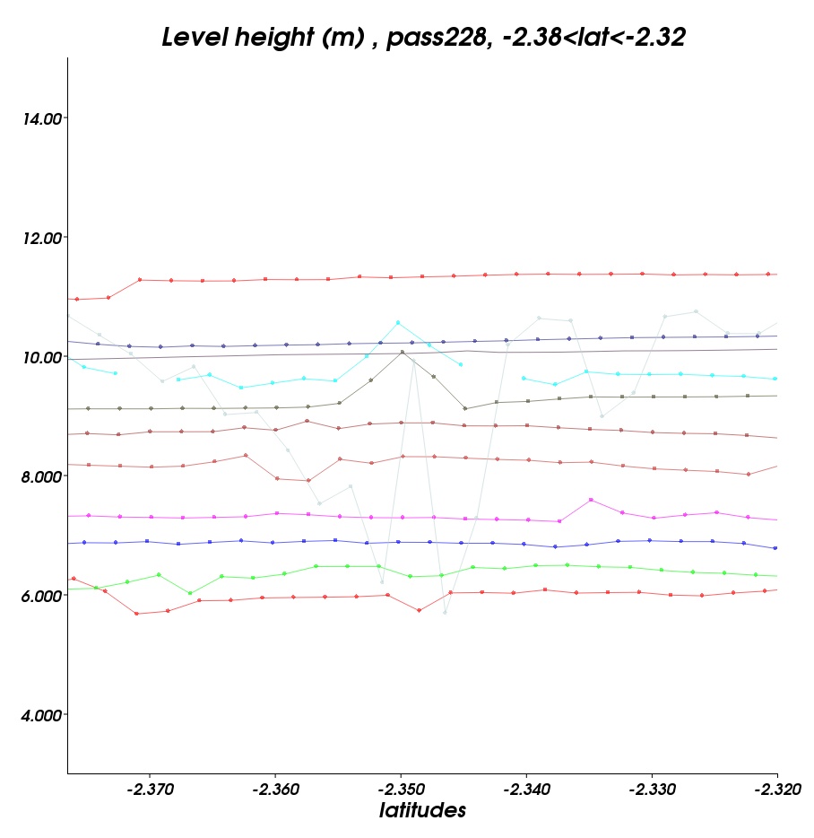
Locations of areas (in yellow) where the curves below are plotted. | ||
 |  |  |
|---|---|---|
Rise of the water levels measured by OSTM/Jason-2 on the Amazon river and its neighbouring areas, nearby the town of Parintins (between Manaus and Obidòs). The water level is risen of 6 m during the last four months over these two areas. These measurements were done under pass 139 and pass 228, from cycle 18 (2008/12/28 - 2009/01/06) to cycle 30 (2009/04/17 - 2009/05/05) and are provided by Pistach project (IGDR products with a specific treatment adapted to continental waters). The curves are drawn with the <link html data toolbox_en.html>Basic Radar Altimetry Toolbox. Credits CLS/Cnes. | ||
Further information:
- Pistach project, data
- Applications: Hydrology
- Nasa Earth Observatory, Heavy Rain Floods Brazil (May 2009)

