High floods in Pakistan and India
Altimetry enable to monitor river levels. Current flooding over the Pakistan and India can be seen with the hydrology-dedicated data.
Many areas in Pakistan and northwest India are flooded caused by incessant rains. Waters in rivers are overflowing, several reservoirs are full causing massive damages on people, villages, cultures and transports.
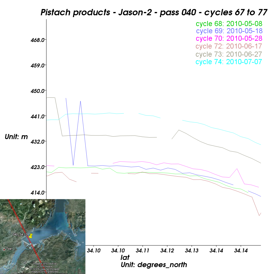
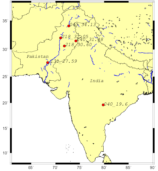
The Pistach products dedicated to coastal and hydrology studies enable to monitor the water level rise in several of these areas. On rivers, a water level difference up to 5 meters is measured between early August and last April. The altimetric measurements made on the Tarbela reservoir on the Indus river seem to reveal a water discharge between the 2010-05-28 and 2010-06-17(see the graph 040_34.13 on the upleft corner below). This large dam (148 m high above the riverbed) also enables to keep waters: since early May-2010, the reservoir water level has risen about 20 m.
 |  | |
 |  | 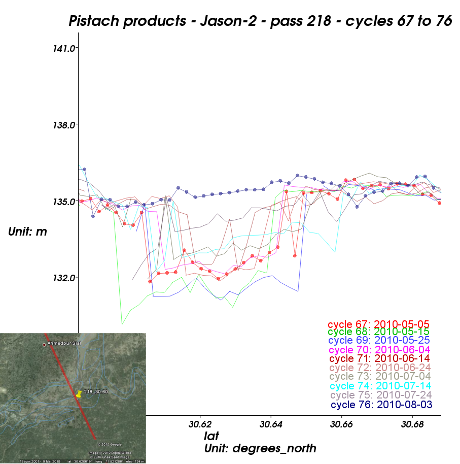 |
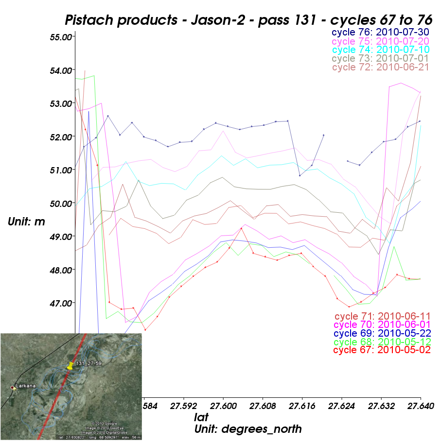 | Altimetry-derived heights over the Pakistan and India, every ten days between April and August 2010 (Jason-2 data processed for hydrology applications).
|  |
Further information:
- Earth Observatory website: Flooding in Pakistan (2010/08/11). Images in infrared and visible light from Modis instrument.

