Record flood in the Amazon basin
After months of intense rains, the Amazon basin sustains record floods. Satellite altimetry can make a major contribution for monitoring fluctuations in continental waters.
Persistent and intense rains over the upstream Amazon basin since September 2011 exceeded water levels in continental waters. These high water levels fed many tributaries and strongly impacted a huge number of people. These people will still affected by diseases or homeless once the waters will begin to recede. .
Satellite remote-sensing techniques and in particularly, satellite altimetry have enabled new hydrological applications to be developed for monitoring fluctuations in continental waters. | 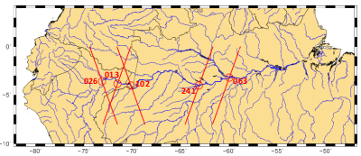 |
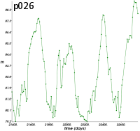
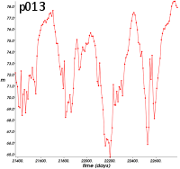
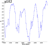
Here, we use the Jason-2 data provided by Pistach project (IGDR products with a specific treatment adapted to continental waters) from July 2008 to today to plot water level time series in several points where the Jason-2 ground tracks overfly the waters. From these time series below, we can see that the current peak flood overpasses the previous ones occurred in 2009 and 2011. The 2012 peak flood occurred in April in upstream basin whereas the water levels is not yet begin to decrease in downstream areas.
 |  |  |
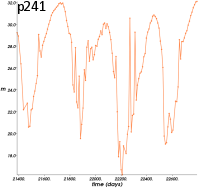 | 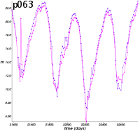 | |
Time series (in julian days) of altimetry-derived heights (in meters) in the Amazon basin from upstream (top left, nearby the town of Iquitos) to downstream (bottom right, nearby the town of Manaus) areas. | ||
Further information:
- Pistach project, Data
- Applications: Hydrology
- Image of the month:
- Apr. 2010: Drought and flood in the Amazon basin
- Mar. 2007: Malaria and altimetry in the Amazon
- Oct. 2001: The Amazon under close surveillance
- Global Voice website: Peru: Iquitos faces aftermath of floods


