World Wave Atlas
S. Barstow (OCEANOR, Norway)
The World Wave Atlas (WWA) is a PC MS-Windows application providing high quality wave and wind data in any region of the global oceans at a spatial resolution and accuracy far better than previously available from global wave compilations derived from visual observations from merchant ships. Measurements of significant wave heights and wind speed from global satellite altimeter missions are the primary data source for WWA.
The development of WWA was started in 1990 in response to an in-house need to develop software to make the voluminous amounts of data from the GEOSAT mission (GDRs) more quickly available in connection with wave climate projects in various parts of the world. Initially, this involved sorting the data into 10 degree. square files, and developing quality control routines. Further, validation of the satellite significant wave height and wind speed measurements were carried out using buoy data collected by OCEANOR worldwide.
Following a 1-year development project supported by the Norwegian Space Centre, OCEANOR's World Wave Atlas was launched commercially earlier this year. This package considerably eases the accessibility of this kind of data to the user community. World Wave Atlas provides full resolution quality controlled and calibrated altimeter wave heights and wind speeds. This means that all available data for an area are included down to the basic 1 sec. / 7 km along track resolution. Any averaging is performed by the user who is also provided with a user-friendly statistical package which allows the spatial and temporal variability of the wave and wind climate to be evaluated interactively and presented either on geographical maps or graphically. This includes the following for user specified areas and/or time periods:
- Frequency and exceedance distributions for significant wave heights and wind speed.
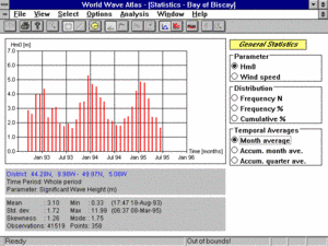
- Time series of average monthly wave heights and wind speed (inter-annual variability).
- Extreme wave analysis for significant wave height, maximum wave height and extreme crest height for user specified return periods. <lip> </lip>
- Variation of wave height or wind speed along a specified track on a specified day.
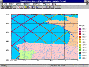
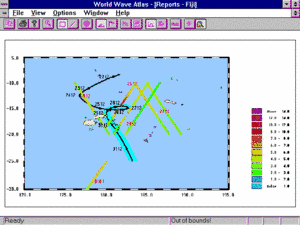
Further, interpretative and descriptive texts are included together with information on wave directions, wave periods and extreme events. Altimeter data from special events such as hurricanes are described in detail and are visualised on geographical maps (see accompanying figures).
 |  |
Figure 1: Presentation of average significant wave height along TOPEX/POSEIDON ground tracks in the Bay of Biscay (10 degree Square). | Figure 2: Example of World Wave Atlas hurricane presentation. The storm's ground track with time identification are shown together with colour coded significant wave heights along satellite tracks passing close to the storm. |
 |  |
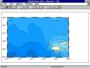
Figure 3: Example from WWA's statistical window. Shows month to month variation in average significant wave height for a user-specified area in the eastern Atlantic off France. | Figure 4: Contours of significant wave height (in m) from the WWA demo for the Fiji Islands in the South Pacific. |
At present, both GEOSAT and TOPEX/POSEIDON data can be provided with the World Wave Atlas. The smallest area that can be purchased is a 10 degree square. regional versions of WWA are also being marketed (e.g. North America, Europe, Far East, Australia). Version 2.0 of the WWA will also allow fixed location data (from buoys, wave models etc.) to be integrated with the altimeter data.
Acknowledgement
OCEANOR is participating in the Pathfinder Phase of the CEO Programme with the World Wave Atlas acting as a test for the CEO information and data exchange concept. This can be found at http://www.infeo.org with links to OCEANOR at http://oblea.oceanor.no where a demonstration of WWA can be found. A free demo can also be provided on request from OCEANOR (wwa(at)oceanor.no).
References
- Barstow S.F., O. Haug, H. E. Krogstad, World Wave Atlas: A PC MS-WINDOWS Product for Wave Climate Assessment Globally. Proceedings of the 3rd Thematic Conference on Remote Sensing for Marine and Coastal Environments, Seattle, Usa, Vol. 1, 95-103 (1995).


