Readying for SWOT data to be used in hydrology applications
Image of the Month - May 2016
In the frame of the SWOT mission, an hydrological simulator is being made available in order to get familiar with the data and test different processing algorithms.
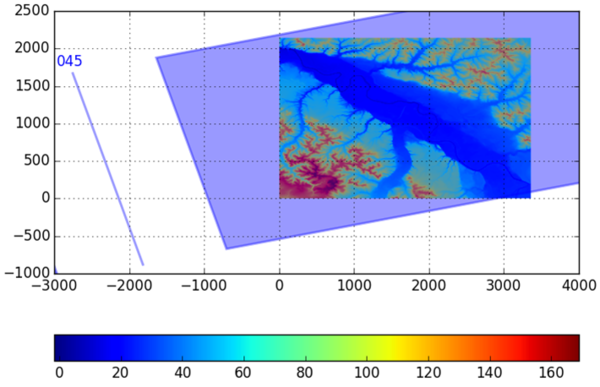
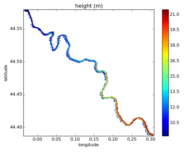
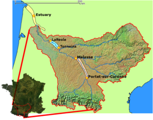
Among the science teams using it, the CERFACS/LNHE/LEGOS teams have investigated a downstream region of the Garonne River between Tonneins and La Réole, while IMFT/IMT/ICUBE/LEGOS teams have studied a section further upstream, between Blagnac and Malause (see left). Top figure shows the simulator outputs obtained for a flow rate of 600m3/s (module of the Garonne River, i.e. the mean inter-annual flow rate) simulated with the Telemac 2D hydrodynamic model for the downstream section. Two other cases have already been simulated: one with a flow of 2500 m³/s (full flow at flood stage level) and a case of flooding with a flow rate of 3800 m³/s (full flow at flood plain level). Simulated SWOT observations in steady-state regime at low flow (160 m³/s), for the Garonne module and for a flow rate of 800 m³/s have also been simulated for the upstream section. It is planned to use multi-temporal SWOT simulations in non-steady-state regimes for these two sections in the near future. These simulations are not only useful for becoming familiar with the time/frequency rationale of future SWOT observations but also enable teams to take this new type of data on board and set up the processing tools needed to gear them to scientific research (to study SWOT’s contribution to current assimilation models, for instance).
Other areas currently being investigated include the Seine and Gironde estuaries [B. Laignel et al., Living Planet 2016: Potential use of the SWOT satellite to characterise the hydrodynamics of French rivers, estuaries and coasts], Lake Poyang in China [LEGOS/SERTIT teams] and the Congo Basin [CNES].
Contacts: Sylvain Biancamaria (LEGOS) and Claire Pottier (CNES)

