A typhoon seen by satellites
Image of the Month - October 2016
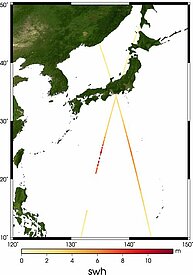
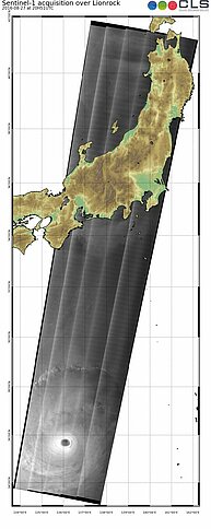
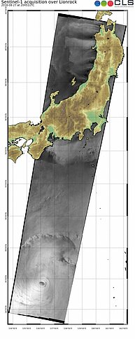
Typhoon is the name of tropical cyclones for the North Pacific. Their generation and consequences are the same: high waves, strong winds, and major damages on lands. They can be seen and detected from a range of space-based techniques. If optical techniques (using the visible part of the electromagnetic spectrum) see mostly the top of their cloud spiral, radars can measure at sea level. Either by imaging the roughness of the surface (SAR), or by the return time of the echo reflected on the surface (altimetry).
Such measurements are not made continuously on the same area, but by integrating such measurements in meteorological models, including wave models (see the first map from the MFWAM Meteo France model integrating Jason-3 data), global view, and forecasts are available.
See also:
- Image of the Month, August 2013: 20 years of typhoons
- Applications: Marine meteorology and atmospheric studies
- Applications: Hurricane Katrina intensification


