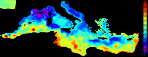
Aviso regional sea surface height products

The Copernicus Marine and Environment Monitoring Service (CMEMS) is in charge of the processing and distribution of Ssalto/Duacs gridded "allsat" series and along-track Sea Level Anomalies, Absolute Dynamic Topographies and Geostrophic velocities over the Global Ocean, Mediterranean Sea, Black Sea, European Seas and Acrtic Ocean areas, in Delayed-Time and in Near-Real-Time .
The Copernicus Climate Change Service (C3S) is in charge of the processing and distribution of Ssalto/Duacs gridded Delayed-time "twosat" series of Sea Level Anomalies, Absolute Dynamic Topographies and Geostrophic velocities over the Global Ocean, Mediterranean Sea, Black Sea.
All those products were formerly distributed by Aviso+ with no changes in the scientific content.
Indeed CMEMS and C3S are dedicated to the distribution of operational products and AViso+ now focuses on the distribution of inoovative products.
Note that the Mozambique area and the Climatologies are still disseminated by Aviso+.
North Atlantic - Agulhas - Gulf Stream - Circumpolar - Gulf of Mexico
| Product type | |
|---|---|
Ssalto/Duacs Experimental along-track and gridded products (sea surface height and velocities)Contents: several experimental products: 1/ 5Hz along-track 2/ gridded computed with Dynamic Interpolation, 3/ gridded combining altimetry and drifters. The proposed variables are sea surface heights and velocities computed with respect to a seven-year mean. Delivered in delayed time for periods defined in the Handbook. | - SSALTO/Duacs Expermiental |
Agulhas current - Florida strait - Oregon - Mid Atlantic Bight
| Product type | |
|---|---|
Ssalto/Duacs Coastal Sea level anomaliesContents: experimental along-track sea surface heights computed with respect to a seven-year mean. | - CoastalDT-SLA |
Arctic Ocean
| Product type | |
|---|---|
Ssalto/Duacs Gridded and along-track Sea level anomaliesContents: gridded and along-track sea surface heights computed with respect to a twenty-year mean. | - Gridded and along-track Sea level heights |
Antarctic Ocean
| Product type | |
|---|---|
Ssalto/Duacs Gridded Sea level anomaliesContents: gridded sea surface heights computed with respect to a twenty-year mean. | - Gridded Sea level heights |
Europe area
| Product type | |
|---|---|
Ssalto/Duacs Along-track Sea level anomaliesCondition of access : The Copernicus Marine and Environment Monitoring Service (CMEMS) has taken over the whole processing and distribution of those products (formerly distributed by Aviso+ with no changes in the scientific content). | - Along-track sea level Heights |
Ssalto/Duacs Seasonal mean and Climatology Gridded Sea level anomalies (1/4°x1/4° on a Cartesian grid)Contents: Seasonal and climatological gridded sea surface heights computed with respect to a twenty-year mean (averaged sea surface heights averaging season by season and climatological sea surface heights calculated by averaging sea level anomalies over a same month). | - DT-Monthly - DT- Seasonal - DT-Clim - |
27 areas defined for X-TRACK coastal products
| Product type | |
|---|---|
X-TRACK Sea level anomaliesContents: along-track sea surface heights computed with respect to a twenty-year mean. | - X-TRACK SLA |


