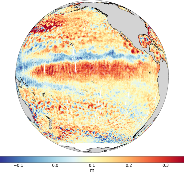
Swot monitors its first El Niño
El Niño is back this winter. Although the phenomenon has long been known for its effects in South America, it wasn't until the early 20th century that it has been identified as an ocean-atmosphere oscillation on the scale of the entire tropical Pacific, from Indonesia to South America, and even beyond regarding its consequences. More recently, thanks to satellite observations of sea surface heights, we have begun to track its evolution continuously. As a result, we can look forward to forecasting the future, even if the phenomenon still holds a few surprises. The winter of 2023-24 was initially feared to be extremely strong, but turned out to be "just" strong - still one of the 5 or 6 strongest episodes observed since 1950, according to Noaa.
This El Niño event is the first to be "seen" by Swot over the period of its maximum development. Thanks to its new KaRIn radar, Swot is able to observe small oceanic structures of a few tens of kilometers in diameter throughout the Pacific, in addition to the mesoscale structures of over 150 km already observable with conventional nadir-looking altimeters. In addition, Swot's KaRIn instrument has the ability to provide hydrological measurements with centimeter-level accuracy. This could offer a more precise understanding of the impact of El Niño on lakes and rivers worldwide.


