Isabel hurricane, September 2003
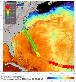
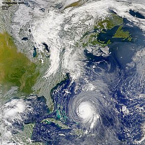
The hurricane Isabel stroked the USA on September 18, 2003. Born over the Atlantic Ocean (see "Recipe for a Hurricane" from Nasa), this hurricane was monitored by all available satellites : visible and near-infrared for meteorological and ocean color satellites (e.g. SeaWifs, above), scatterometers (that measure sea surface wind speed, aboard SeaWinds -- see below -- or ERS-2), sea surface temperature sensors (AATSR aboard Envisat, AVHRR aboard the Noaa satellites, see below), radiance and height cloud measurements (MISR aboard Terra).
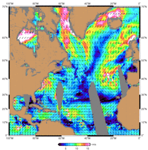
This hurricane's signature can also be seen on altimetric satellite measurements (Jason-1 or Envisat, above), which can give access to wind speed and wave height.
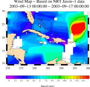
On the left, wind speed from Jason-1 altimeter centered on September 15, 2003. A similar map is available for for Envisat.The altimeters can also give access to wave height Jason-1, Envisat over the same period). (Credits CLS/Cnes). Map from SeaWIfs satellite (ocean color) on September 15, 2003 (Credits Nasa/GSFC).