
Opal hurricane, October 1995
Hurricanes are among the most frequent catastrophic events in warm seas. Their birth is now well understood, but forecast of their path is of major importance for people living there.
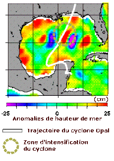
Altimetry contribute to this forecast by collecting wave height and wind speed data, but also by the knowledge of ocean circulation it brings. Since heat of the underlying ocean plays a major role in hurricane birth and intensification, cold and warm eddies seen by Topex/Poseidon can modify path and intensity of hurricanes.
Sea level anomalies from Topex/Poseidon data. Hurricane intensification (drop in atmospheric pressure from 965 to 916 hPa) correlates with a warm core eddy observed by altimetry.
(Credits Noaa/AOML)
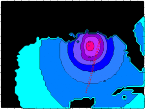
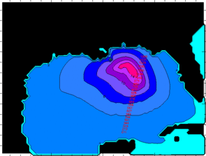
Wind speed (in m/s) and wave height (in m),65 h after Hurricane Opal passage, on October 4, 1995.
(Credits Météo-France).

