Correction of High Frequency signals
The high frequency oceanic signal (pressure and wind meteorological forcing) is badly sampled by altimeter measurements (10 days cycle for Jason-1, Jason-2, 35 days for Envisat, AltiKa). This high frequency signal is thus aliased into the lower frequency band (periods >20 days for Jason-1), and pollutes the ocean variability estimation made from altimetry.
The classical Inverted Barometer (IB) correction used for altimetry formulates the static response of the ocean to atmospheric pressure forcing, and wind effects are totally ignored. Several studies have pointed out that the ocean has a clear dynamic response to pressure forcing at high frequencies (periods below 3 days) and at high latitudes, and that wind effects prevail around the 10 days period (Fukumori et al. 1998; Ponte and Gaspar 1999; Mathers 2000; Fu 2003; Webb and de Cuevas 2002 2003). Thus this high frequency variability needs to be corrected from independent model with centimetric accuracy.
Dynamic ocean response to atmospheric wind and pressure forcing - Mog2D
Mog2D (2 Dimensions Gravity Waves model) is a barotropic, non linear and time stepping model, derived from Linch and Gray (1979, Greenberg and Lyard, personnal communication). The model governing equations are the classical shallow water continuity and momentum equation.
Mog2D main originality is a finite elements space discretisation, which allows increasing the resolution in areas of interest like strong topographic gradients areas or shallow waters. The grid size ranges from 100 km to 10 km in coastal, shallow seas. The simulation domain includes Mediterranean Sea, Hudson Bay, Bering Strait, Arctic Ocean, Wedell and Ross Seas and some semi-enclosed seas: Red sea, Persian gulf, Black sea and Baltic sea. The model is forced by the pressure and wind speeds at the altitude of 10m from ECMWF analysis, with a temporal resolution of 6 hours. The spatial resolution of the ECMWF analysis becomes finer with time (from native N256 grid in 2002 to N640 grid at this time: July 2015).
Dynamic Atmospheric Correction: a new HF correction combining MOG2D(HF) and Inverted Barometer (LF)
Former performances studies made on altimetry have proven the efficiency of a correction combining the high frequencies of the barotropic model forced by pressure and wind (MOG2D), to the low frequencies of the IB model (SWT of New Orleans, 2002).
The S1 and S2 oceanic variability is induced by both gravitational forcing and atmospheric forcing. Those signals are well modeled by tide models. Moreover, the ECMWF operational analysis are available every 6 hours, thus the very high frequency atmopsheric signals S1 S2 are badly sampled. In order to homogenise the tides and DAC processing for altimetry for these frequencies, the S1S2 pressure forcing is removed in the DAC computation, using monthly S1S2 climatologies computed from ECMWF 6h pressure fields (Ponte, R. M., R. D. Ray, 2002: Atmospheric pressure corrections in geodesy and oceanography: A strategy for handling air tides,Geophys. Res. Lett., 29, 2153, DOI: 10.1029/2002GL016340)
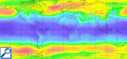
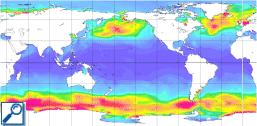
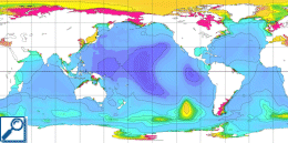
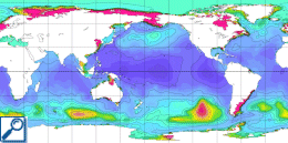
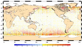
The figure gives the spatial pattern of the influence of the new DAC correction compared to the IB one, on Jason-1 altimeter data for one year.
The products delivered:
- GDR and IGDR products:The Ssalto ground segment processing chains provides dynamic atmospheric corrections in an operational context (Jason-1, Jason-2, AltiKa GDRs and Jason-2, AltiKa IGDRs). Note that in those products, the DAC correction is given in two parts: the IB correction and the Dynamic Response to Atmospheric Forcing correction (hf_fluctuations_corr): IB+hf_fluctuations_corr=DAC. Moreover, the high frequency correction in the IGDRs is degraded compared to GDR because the temporal filtering window is decentered in NRT. Nevertheless, thanks to the use of forecast data in the computation, the IGDR correction has been improved recently.
- DAC gridded products are also delivered by Aviso+. Note that these grids correspond to the sum of the fields IB+hf_fluctuations_corr from GDRs' correction. Please refer to the product page.
Within the Climate Change Initiative (CCI) project (ESA), a specific DAC-ERA has been computed for climate applications using the ECMWF ERA-INTERIM reanalysis on the 1991-2014 period. This DAC-ERA is significantly improved for the first years of altimetry (Carrere, L., Faugère, Y., and Ablain, M.: Major improvement of altimetry sea level estimations using pressure-derived corrections based on ERA-Interim atmospheric reanalysis, Ocean Sci., 12, 825–842, https://doi.org/10.5194/os-12-825-2016, 2016.)
- See also DAC litterature and publications.
