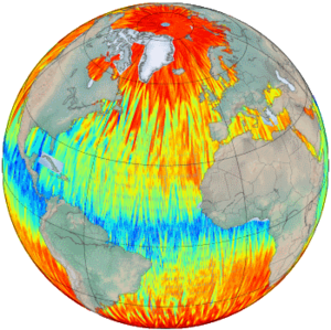
GPD+ Wet tropospheric correction
Types of dataset: auxiliary product. Wet tropospheric correction for the ERS-1, ERS-2, Topex/Poseidon, Envisat, Jason-1, Jason-2, Cryosat-2 and Saral/AltiKa missions.
Contents: GPD+ (GNSS (Global Navigation Satellite Systems) derived Path Delay Plus) wet tropospheric correction for each point in the corresponding GDR.
Use: coastal applications, ocean applications
Description: Due to its large space-time variability, the wet tropospheric correction (WTC) is still considered a significant error source in satellite altimetry. The GPD+ dataset is the result of the most recent algorithm developed at the University of Porto to retrieve improved WTC for radar altimeter missions. The GPD+ WTC are estimated by space-time objective analysis, by combining all available observations in the vicinity of the point: valid measurements from the on-board microwave radiometer (MWR), from GNSS coastal and island stations and from scanning imaging MWR on board various remote sensing missions.
Format: NetCDF
Geographic coverage: Global
References:
- Fernandes, M. Joana, Clara Lázaro, Michaël Ablain, and Nelson Pires. 2015. “Improved Wet Path Delays for All ESA and Reference Altimetric Missions.” Remote Sensing of Environment 169 (November): 50–74. doi:10.1016/j.rse.2015.07.023.
- Fernandes, M., and Clara Lázaro. 2016. “GPD+ Wet Tropospheric Corrections for CryoSat-2 and GFO Altimetry Missions.” Remote Sensing 8 (10): 851. doi:10.3390/rs8100851.
Copyright : 1993- ongoing. These products were developed and validated by the University of Porto, and are distributed by Aviso+. Publications should include the following statement in the Acknowledgments: “The data used in this study were developed and validated by the University of Porto, and distributed by Aviso+, France”.
| Satellite | Type | Form-based access | Data period |
|---|---|---|---|
ERS-1 ERS-2 Envisat TOPEX/Poseidon Jason-1 Jason-2 Jason-3 Cryosat-2 Saral/Altika | along-track |
or | cycles 1 to 53 (AVISO convention), 1991/08–1996/04 cycles 1 to 167, 1995/04–2011/05 cycles 6 to 113, 2002/04–2012/03 cycles 1 to 481, 1992/07–2005/08 cycles 1 to 374, 2002/01–2012/03 cycles 1 to 383, 2008/05–2019/10 cycles 1 to 147, 2016/02-2020/02 subcycles 4-126, 2010/07-2020/01 cycles 1 to 35, 2013/03/-2016/07 |


