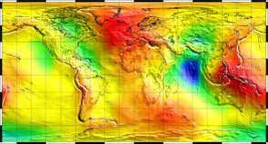
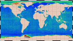
Mean Sea Surface MSS_CNES_CLS2022 Description
The mean sea surface MSS_CNES_CLS2022 has been computed using a 29-year [1993-2021] period of altimetric data.
Compared to the 2015 previous version, this new determination focuses on better accounting for interannual and seasonal ocean variability, on the significant improvement on polar Oceans, and on the improvement of the shorter wavelengths of the static parts of the MSS.
As usually, the mean profiles from ERM (Exact Repeat Mission) missions that provide the most accurate estimate of the oceanic mean content are used. Compared to the previous CNES_CLS2015 MSS, this version includes new High Resolution datasets from CryoSat-2 and AltiKa, filtered at 5 Hz to obtain a better signal to noise ratio.
In order to be homogeneous, all these data were pre-processed using:
- For Cryosat-2 20Hz: the ESA, L2 NOP-IOP-GOP SAR, Version Baseline C https://doi.org/10.5270/CR2-3f3c491 and L2 NOP-IOP-GOP LRM, Version Baseline C https://doi.org/10.5270/CR2-05fbc11
- For AltiKa 40Hz: the CNES GDR-Fs, https://www.aviso.altimetry.fr/en/data/products/sea-surface-height-products/global/gdr-igdr-and-ogdr.html
- For all the other missions, the Mean Profiles have been computed with the Level-3 (along-track) SLAs of the DUACS products (version DT2021, distributed by CMEMS, https://doi.org/10.48670/moi-00146)
- The Level-4 (maps) SLAs of the DUACS products (version DT2021, distributed by CMEMS, https://doi.org/10.48670/moi-00148) which are referenced over a period of 20 years [1993-2012].
This new solution is also improved in arctic region using an optimal combination between conventional SSH and LEADS (linear fractures) over free ice areas (the LEADS were processed by SSALTO/DUACS (DOI https://doi.org/10.24400/527896/a01-2020.001 version 1.2, along-track and distributed by AVISO+ (https://www.aviso.altimetry.fr) with support from CNES).
The mapping method is based on a local least square collocation technique which also provides an estimation of calibrated error.
Our technique takes into account different types of noises (altimetric noise, residual correlated noise of oceanic variability, along-track residual biases) which are determined independently for each observation. Particular attention has been paid to improve the omission error of seasonal and interannual ocean variability, especially for wavelengths below 150 km, which are not fully estimated in the current DUACS MSLA product. A new high frequency correlated noise has also been implemented to reduce the residual noise for wavelengths less than 5 km.
In addition, for a more precise determination of the shortest wavelengths lower than 30 km, a new cross-covariance model was also fitted locally each 3 minutes.
This mean sea surface contains:
- Over ocean, the steady state of the ocean representative of a 20 years period [1993-2012],
- In continental areas: MSS is replaced by the EIGEN6C4 (Foerste, C. et al., 2014, https://doi.org/10.5880/icgem.2015.1) geoid model.
References:
- Schaeffer, P.; Pujol, M.-I.; Veillard, P.; Faugere, Y.; Dagneaux, Q.; Dibarboure, G.; Picot, N. The CNES CLS 2022 Mean Sea Surface: Short Wavelength Improvements from CryoSat-2 and SARAL/AltiKa High-Sampled Altimeter Data. Remote Sens. 2023, 15, 2910. https://doi.org/10.3390/rs15112910
- Schaeffer et al., OSTST 2022, MSS_CNES_CLS2022, https://doi.org/10.24400/527896/a03-2022.3310
| Name | MSS_CNES_CLS2022 |
| Reference ellipsoid | T/P (or WGS84) |
| Reference time period | 1993-2012 (20 years) |
| Geographic coverage | Global (79.4°S to 88°N) |
| Spatial resolution | Regular grid with a 1/60° (1 minute) spacing (i.e. ~1.8 km at the equator) |
| Grid | 21600 points in longitude / 10050 points in latitude (79.4°S to 88°N) |
| Method | Local least square collocation method |
| Estimation error | YES (in cm) - calibrated formal error. |
Altimetric dataset
|
|
Back to product page


