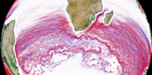
Mesoscale Eddy Trajectory Atlas Product META3.1exp DT
Types of dataset: multimission altimeter products.
DOI:
- 10.24400/527896/a01-2021.001 for META3.1exp DT allsat version - more metadata
- 10.24400/527896/a01-2021.002 for META3.1exp DT twosat version - more metadata
Contents: multimission altimetry-derived eddy trajectories in version 3.1 exp DT (for Delayed-Time) computed with two series of upstream data: the "two satellites" constellation maps (distributed by C3S) and the "all satellites" constellation maps (distributed by CMEMS).
Use: study of ocean mesoscale eddies
Condition of access: These products are available free of charge for any purpose (scientific, operational, commercial, etc.) as stated in the licence agreement. Users should keep in mind that these products are experimental products. Notably, they are not produced on an operational basis.
Open data access service: https://data.aviso.altimetry.fr/aviso-gateway/data/META3.1exp_DT/
Description: Anticyclonic and Cyclonic eddies detected from the multimission altimetry datasets, with their location, contours, amplitude, radius speed and associated metadata, for the whole altimetry period: 1993-ongoing
Geographic coverage: global
Format: NetCDF-4 Classic with CF standards.
Video: two versions of the detection algorithms used to produce the Delayed Time Mesoscale Eddy Trajectories Atlas are analysed: the PET (following Mason et al. 2014, available on https://github.com/AntSimi/py-eddy-tracker ) used for META3.1exp DT (top) and OSU (similar to Chelton et al. 2011) used for META2.0 DT (bottom). For complete description, please visit the link: https://youtu.be/4Vs3ZJNMViw .
Tools:
- User Handbook: Mesoscale Eddy Trajectory Atlas Product Handbook META3.1exp DT, SALP-MU-P-EA-23489
- Statistical analysis document (Figures following Chelton et al. 2011): one for the "allsat" constellation and one for the "twosat" constellation.
- Reading software: examples in Python programming language. Details on Aviso+ Users Newsletter #14, page 4: Tools for the Mesoscale Eddy Trajectory Atlas.
- Code delivery: the open source code is available at https://github.com/AntSimi/py-eddy-tracker from version META3.0 onwards. When using the code, please cite "The code used to compute the Mesoscale Eddy Trajectories Atlas from version 3.0 onwards, was developed in collaboration between IMEDEA (E. Mason) and CLS, is freely available under GNU General Public License https://github.com/AntSimi/py-eddy-tracker ".
- Image of the month, June 2017: Eddies everywhere
Citation: If you use the data, please cite:: "The altimetric Mesoscale Eddy Trajectories Atlas (META3.1exp DT) was produced by SSALTO/DUACS and distributed by AVISO+ (https://aviso.altimetry.fr ) with support from CNES, in collaboration with IMEDEA (DOI: 10.24400/527896/a01-2021.001 for the META3.1exp DT allsat version and 10.24400/527896/a01-2021.002 for the META3.1exp DT twosat version)".
References:
- Pegliasco, C., Delepoulle, A., Mason, E., Morrow, R., Faugère, Y., Dibarboure, G., 2022. META3.1exp: a new global mesoscale eddy trajectory atlas derived from altimetry. Earth Syst. Sci. Data 14, 1087–1107. https://doi.org/10.5194/essd-14-1087-2022
- Mason, E., A. Pascual, and J.C. McWilliams, 2014: A New Sea Surface Height–Based Code for Oceanic Mesoscale Eddy Tracking. J. Atmos. Oceanic Technol., 31, 1181–1188, https://doi.org/10.1175/JTECH-D-14-00019.1
Copyright : 1993 - ongoing CLS - Cnes - IMEDEA
Eddy dataset
| Product | Satellite | Authenticated access service | Frequency | Data period | File weight |
|---|---|---|---|---|---|
| Merged version 3.1exp delayed-time | allsat | see your MY AVISO+ | yearly | From Jan 1993 to Mar 2020 | 3 files for Cyclonic and Anticyclonic eddies: long series: max 7.1 Gb shorts series: max 510 Mb untracked series: max 95 Mb |
| twosat |
See also
META3.2 DT version
META3.2exp NRT
META3.0exp NRT (this version is not maintained anymore)
META2.0 DT (not recommended,this version is not maintained anymore)
Back to previous page


