Floating sargassum algae detection with GOES-16 satellite.
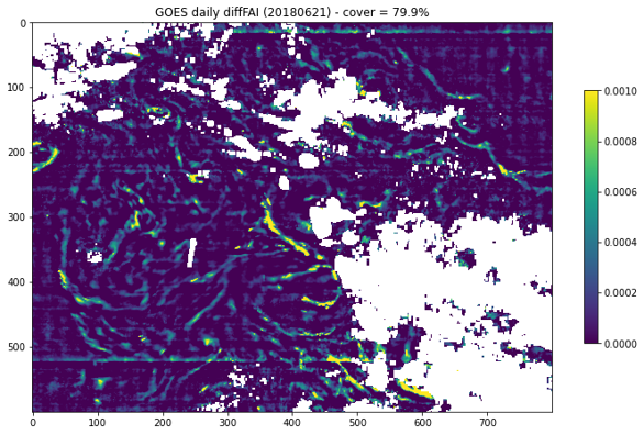
Maps of sargassum detection index FAI anomaly (Anomaly of Floating Algae Index) produced in real time from the geostationary satellite GOES-16 (ABI sensor).
Types of dataset: mono-mission dataset using ABI sensor onboard GOES-16 satellite.
DOI: 10.24400/527896/a01-2022.008 - more metadata
Contents: maps of sargassum detection index (FAI anomaly): instantaneous maps of ABI-GOES16 every 10 minutes and daily mean maps at 1-km resolution.
Use: improve the sargassum detection in the Caribbean region by increasing the satellite coverage of sun-synchronous sensors usually used for sargassum detection.
Condition of access : these products are delivered for any purposes as stated in the licence agreement
Description: daily gridded products provided in near real time since 28 March 2022 produced in the frame of a jointed initiative CLS-Hygeos with the support of the CNES. Each map represents the sargassum presence index averaged over one day
Citation: When using the Floating Algae Index using GOES-16 satellite product, please cite “The Floating sargassum algae detection product has been produced by CLS and Hygeos with support from CNES, distributed by Aviso+ (DOI 10.24400/527896/a01-2022.008).”
Geographic coverage: Tropical Atlantic from -5°S to 40°N, 100°W to 12°W
Format: NetCDF-4 Classic with CF standards.
Tools:
Copyright : 2022 - ongoing Cnes, Cls, Hygeos
Detection of floating sargassum algae - GOES-16
| Product | Dataset | DOI | Authenticated access service | Frequency | Data period | Dataset name |
|---|---|---|---|---|---|---|
| Sargassum algae detection index - GOES-16 | hr dataset : Sargassum FAI anomaly maps calculated between 10am and 7:50pm ITC every 10 minutes. A day contains 60 cards | 10.24400/527896/a01-2022.008 | see your | - | From 01 Mar 2022 - ongoing | dataset-sargassum-abi-goes-global-nrt-hr |
dm dataset: daily means of the 60 instantaneous maps of Sargassum FAI anomaly. | dataset-sargassum-abi-goes-global-nrt-dm |

