Sargassum Floating Algae Index with Sentinel-2A&B and Landsat 8&9 satellites.
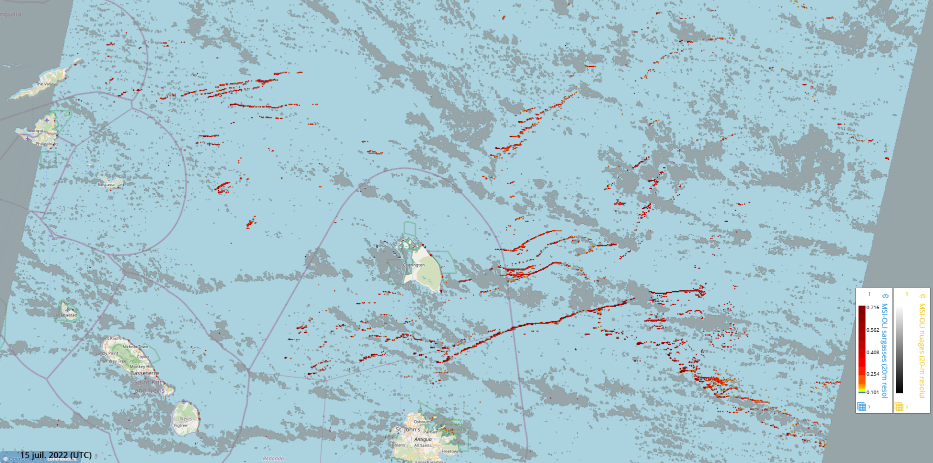
Composite maps of sargassum detection index NFAI (Normalized Floating Algae Index).
Types of dataset: multimission dataset using MSI instruments onboard Sentinel-2A&B satellites and OLI instruments onboard Landsat-8&9.
DOI: 10.24400/527896/a01-2024.001 - more metadata
Contents: sargassum detection index (NFAI) maps computed at 20m on specific HR geographical areas from images of MSI Sentinel-2A & 2B resolution every 2-3 days, and OLI Landsat-8 & 9 every 8 days at most, and merged in 300m resolution maps after each satellite pass covering the area of interest.
Use: refine sargassum detection near coast thanks to high resolution sensors.
Condition of access: these products are delivered for any purposes as stated in the licence agreement
Description: gridded products provided in delayed-time since December 7th, 2020, to a month before current date, made available as part of SeSaM SCO project (https://www.spaceclimateobservatory.org/sesam). Each map represents the sargassum presence at 300m.
Citation: when using this product, please cite: “The Sargassum Floating Algae Index product has been produced by CLS operationally in the frame of the SAMTool service. The product is distributed by Aviso+ (DOI 10.24400/527896/a01-2024.001) with support from SCO-CNES.”
Geographic coverage:: coastal waters from 11°N to 22°N, 89°W to 57.5°W up to 20 km from the shore
Format: NetCDF-4 Classic with CF standards.
Tools:
Copyright : 2020 - ongoing, Cls
Sargassum Floating Algae Index - MSI and OLI
| Product | Satellite | DOI | Authenticated access service | Frequency | Data period | Dataset name |
|---|---|---|---|---|---|---|
| Sargassum detection - Floating Algae Index - MSI and OLI | MSI instruments on Sentinel-2A&B and OLI instruments on Landsat 8&9 | 10.24400/527896/a01-2024.001 | see your MY AVISO+ | Daily | 2020/12/07 to one month delay | dataset-sargassum-cls-merged-msi-oli-global-lr |

